| Start Point: | Ashton, Union Island |
| Duration: | 2 hours |
| Difficulty: | 3 |
| Height of Ascent: | 1000 ft |
Mount Taboi is the highest peak on Union Island at 1000ft high. The first two thirds of the route is along a well-used path, but the path then peters out and you are left to find your own way up to the summit. We did the ascent in sturdy sandals, but a pair of walking shoes would be better. It would also be a good idea to take a pair of long trousers to stop your legs getting scratched near the top. The view from the top is spectacular.

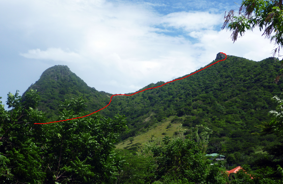
From the centre of Ashton, you cannot miss the rugged cliffs of Big Hill which loom above the town. Mount Taboi is out of view behind Big Hill and the path that you are going to take curves around the base of Big Hill. (In fact the same path leads to the top of Big Hill as well.)
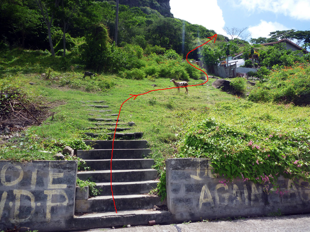
The start of the path is tricky to find. From the main road in Ashton, go up the road opposite the Jehovah’s Witness church which leads steeply up towards the “Big Hill”. You will see a set of steps at the end of the road. At the top of the steps, you need to cross the road and walk up a few more steps into a steep field (see photograph). Follow a faint path up to the right towards a house, which you should leave to your right. You will see a path going up, to the right, behind the house, which is the start of the route.

The path continues up, curving around the lower slopes of the “Big Hill”. The first part is mostly under cover with a few places that open out into grass land with great views of Ashton. There are a couple of places where the path branches – just take the one going up. After about half an hour, you will come into a steep meadow where the path becomes indistinct. You will see the peak of Mount Taboi to your right with a big rocky outcrop at the top. Just keep going up towards the ridge and gradually moving to the right.


Once you get to the ridge and start moving towards the peak, there is one more small meadow. At the top of this the path disappears and you are faced by a wall of bushes and trees. We found a faint, overgrown path at the right hand side. Long trousers are useful from this point onwards.
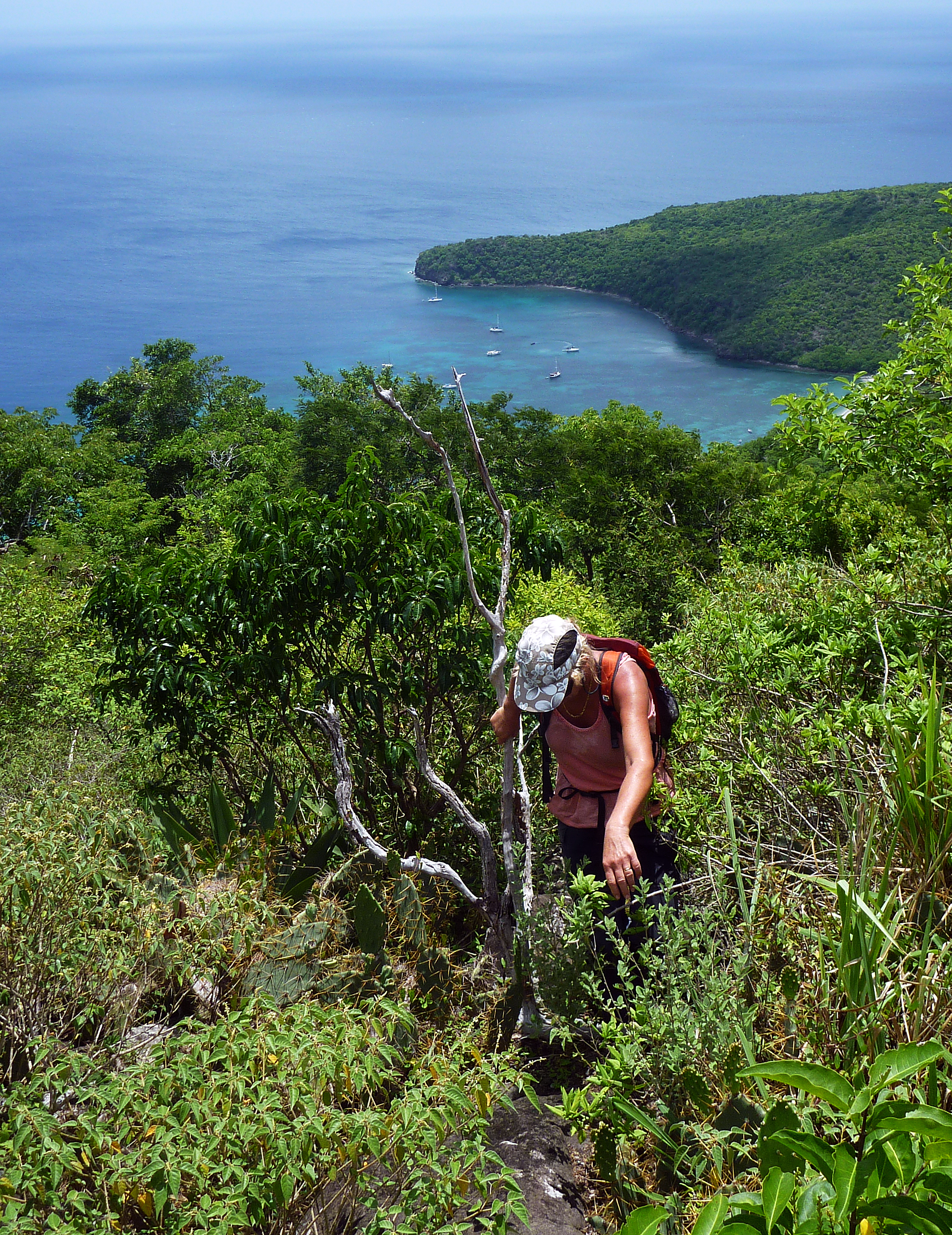
Follow the line of the ridge, which goes through patches of bushes and cacti. Near to the top of the ridge, we found ourselves in cacti field which wasn’t pleasant – it may be better to keep in the trees to the right of the ridge.
Eventually you will come to the rocky peak, where you will be faced with a steep overhanging cliff. Turn to the right and scramble around the corner, following the edge of the rock-face up which curves to your left.
There’s a bit more pushing through bushes and ducking under trees before you arrive at the top and the spectacular view of the whole of Union Island and the Grenadines. It took us about one and half hours to get up including back-tracking a couple of times.

The route back down is a reverse of the ascent. The descent only took 30 minutes.
Note: We started in Chatham Bay, walking up the path from the beach, along the road and down into Ashton. This took us an hour each way.
