1 July 2015 Ratua Island, Santo
I feel like we’re in a time warp. In our first six weeks in Vanuatu we were totally immersed in the daily lives of the ni-Vanuatu people, going to traditional villages and seeing extraordinary things. In contrast, our past ten days have been in and around Luganville, mostly anchoring next to tourist hotels. I haven’t been on land or talked to a local for a week.
Tropical Depression TD17F is still forecast to intensify over the Solomons tomorrow and should then loop down past the Louisiades as it dissipates. We’ll have to keep an eye on it, but it looks like a trough will pass over Vanuatu on the 3rd July, then we could leave with good South-east winds as long as the depression follows the forecast path. If we leave and it heads more south then we could get some horrible weather. All we can do it watch and wait.

It was a nice sunny day, so I emptied the aft lazarette and spread everything out on the foredeck to dry in the sun. When we came up from New Zealand, I neglected to close the locker lid tightly and we had so much water going over our decks that the lazarette filled with water. This water then sneaked through a hole in the wall of the locker (where wires pass through to the stern arch) and down into our bilges. Having cleaned the locker, I squeezed loads of silicone sealant into the hole and between the wires, so hopefully that little problem will be fixed.
Glenys continued working on the bimini panels. She’s put clear plastic windows in the aft panel and one of the side panels, but then realised that we use the side panels as a sun shade and now the sun will (errr) shine through the window directly where we sit in the cockpit. So she’s now had to install a flap that will cover the window - she finished the port side and only has the starboard one to do now.
In the afternoon, we went on a mini-expedition with the other three boats to the “Blue Hole” on the nearby island of Malo. It involved dinghying across the windy, bumpy, one-mile wide channel and into a small river. I was glad we have a big AB dinghy and a 15hp engine - “Deese” and “Red Herring” only had 3.5hp engines and struggled against the 2-3 knot current.
We meandered our way up the river, dodging low hanging branches, until it opened up into a large lagoon. It wasn’t blue and it wasn’t fresh water, so we were a little disappointed, but the delightful trip up the river made it worthwhile.
2 July 2015 Ratua Island, Santo
The Tropical Depression has intensified and is now called Tropical Cyclone Raquel with sustained winds of 55 knots gusting to 70 knots. It’s the first cyclone in this area in July since records began. At the moment, it’s 750 miles to the north-west of us and is forecast to head south-west across the Louisiades, so we’d be very unlucky if it headed our way. Unfortunately, the weather looks very unsettled for the next two weeks, so we’re not sure when we’ll get away from Vanuatu.
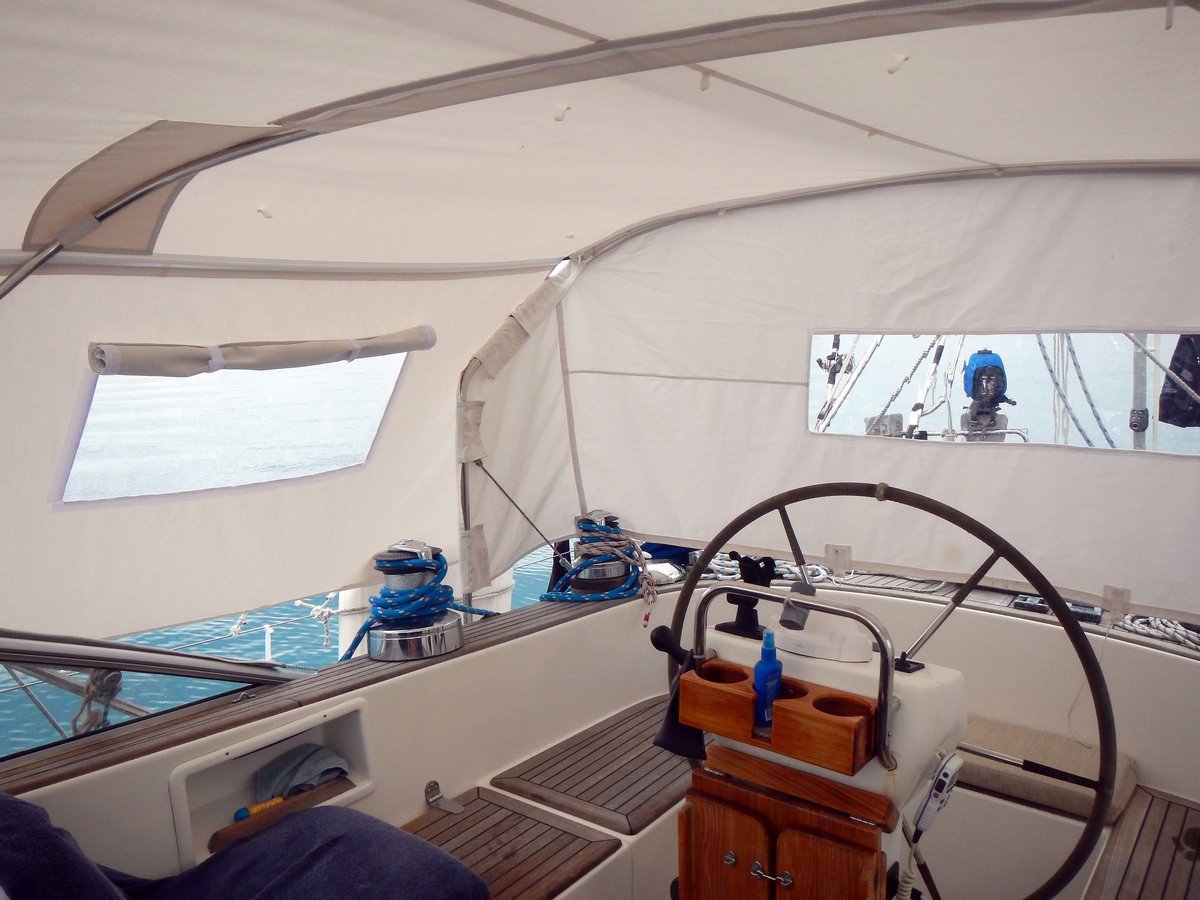
I had a lazy day pottering about, looking at Indonesia, doing a couple of small jobs and I went snorkelling. Glenys carried on with her sewing projects and has finally finished the rain protection panels for the bimini, which look good.
While we’ve been waiting here in Ratua, we’ve been watching a movie each night and have just finished working our way through all seven Harry Potter movies - it’s time to leave before we’re tempted to watch all twenty three James Bond movies.
3 July 2015 Ratua Island, Santo
Cyclone Raquel is still hanging around over the Solomons, but the maximum sustained winds have been downgraded to 45 knots gusting 60 knots. Interestingly, this Cyclone was spawned by “equatorial westerlies”. This burst of upper level west winds started off from the Asian monsoon and produced eddies, helping create tropical lows. At the same time that Cyclone Raquel was created, there were another three tropical lows in the northern hemisphere - two of these have turned into full blown Typhoons (Chan-Hom and Linfa) which are building to have sustained winds of 130 knots and 70 knots respectively.
There’s been a lot of discussion about this year being an “El Nino”, when the sea temperature is higher than normal. During an El Nino episode, weather patterns tend to be drawn closer to the equator and the South Pacific Convergence zone tends to be tugged north and east of its normal position. I wonder if El Nino is helping to spawn these Cyclones because there’s more heat energy stored in the atmosphere.

“Deese” are heading to Indonesia and are under time pressure to get there before their visas expire on the 23rd July, so they left today hoping that the cyclone behaves as forecast. Theoretically, they should have good winds for a few days, but could then encounter the remnants of Cyclone Raquel - I hope that it disperses as predicted.
There were heavy showers for most of the day, so we had a quiet day pottering about then went for a snorkel in the afternoon. As soon as we entered the water, I spotted two Octopuses having a fight, their colours flaring impressively as they wrestled. One shot off leaving the victor standing proud on a coral head. I started to take photographs, but it was a challenge because the water was very murky and the octopus slunk into a hole or jetted off when I approached. I did manage to get a couple of reasonable photos.

We invited Graham and Karen from “Red Herring” over for a few beers. They’re heading to Indonesia and have been there before, so we picked up some interesting information.
4 July 2015 Ratua Island, Santo
The cyclone is now starting to weaken and it’s expected to be a Tropical Depression by tomorrow. We’re now thinking going around to Luganville on Monday (6th) to clear out and probably leave in the afternoon. The forecast is not ideal with rain at first then light winds later on, but we can’t wait any longer otherwise we won’t have any time in the Louisiades.
I managed to get a good internet connection (for a change) and spent practically all day, reading blogs on future destinations. When I find a good blog, I print the entries as a PDF file, so that we can read them off line. It takes a lot of time to organise and rename the files, so that they make sense on our iPad and allow us to do research while we’re sailing on long passages.
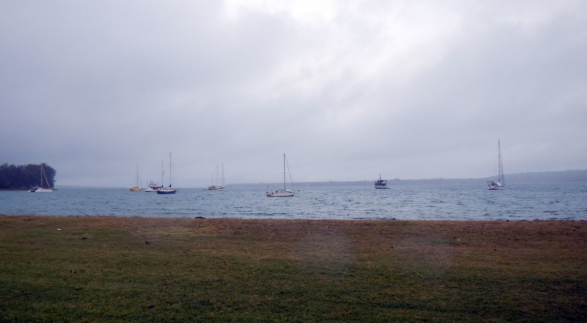
Glenys made courtesy flags for Papua New Guinea and Indonesia and then chilled out.
5 July 2015 Ratua Island to Luganville, Santo
The weather looks reasonable to go tomorrow, so we pottered about in the morning tidying up, getting ready for sea and using the internet to do more research for the future - mostly looking at what we’ll be doing in Malaysia and Thailand next year.
We’re planning to be in South-east Asia for 15 months and then, in February 2017, expect to be sailing to Sri Lanka and across the Indian Ocean to South Africa. In November this year, our son Craig and his girlfriend Kristen are meeting us in Thailand and our other son Brett is getting married in June 2016, so we’ll be flying back to the UK, but we’re not sure what we’re going to do for the rest of the time. We have the South-west Monsoon to contend with between June and October which brings heavy rain, so it’s complicated.
In the afternoon, we motored around to Luganville and anchored off the Beachfront Resort, which wasn’t too bad although it’s still a lee shore and choppy. We carried on tidying up and, by nightfall, the boat was all ship-shape and we’re ready to clear out and do our final provisioning in the morning. After so long lurking about in Ratua Island, we’re both a bit nervous about doing a long seven day passage.
6 July 2015 Luganville to The Louisiades (Day 1)
We were up early and on the beach by half past seven, clutching four, 5-gallon fuel cans and four bags of rubbish, which we've accumulated over the past four weeks. Graham and Karen from "Red Herring" shared a taxi into town with us. Our first stop was to drop off the rubbish. There's no proper place to dump garbage in Luganville and the hotels want to charge $3 per bag to take it. The locals seem to dump bags on certain street corners, so we did the same on a corner near to the vegetable market.
I dropped the fuel cans off at a garage to pick up later and then the taxi took us to the customs office to start the out-going clearance. It was fairly painless apart from having to pay $110US for port fees. The process was: customs for form filling; port office to pay fees; customs office for issue of clearance; then immigration for more form filling and passports stamped.
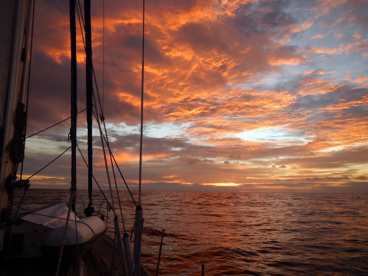
Despite our worries about having illegally drunk 18 bottles of the duty free wine that we bought in Port Vila, the customs officer simply asked if we had the bottles of wine on board. I truthfully told him that we did have the bottles, but neglected to tell him that some of them were empty...
I went to the garage to fill the jerry cans then caught a taxi back to the boat, while Glenys went to the market and supermarket to buy food. By midday, we were both back on board and quickly had the food stowed away; the dinghy stowed on deck and were motoring down the channel just behind "Red Herring".
We were a little bit late with the tides and hit a 2.5 knot current against us at the south end of the channel, but were soon clear and following the southern coast of Santo. After a couple of hours of motoring, we'd escaped land enough to get some wind and had a good downwind romp for five hours, sailing at 7 knots. Unfortunately, the wind started to drop just after sunset and, by half past nine, we were only doing 2-3 knots. The seas were still quite big, so our sails were slatting and banging, which sounds horrible, so I cracked up and turned on the engine.
By dawn, we were still motoring, but we don't have enough fuel to motor all the way to our destination, so we pulled out the sails and bumbled along at 2.5 knots.
7 July 2015 Luganville to The Louisiades (Day 2)
After breakfast, I dragged our asymmetrical spinnaker on deck and rigged it up, but the fickle wind wasn't enough to inflate it properly. The swell was still 1-2 metres, so we were rolling causing the spinnaker to collapse and plaster itself on the shrouds. I decided to leave it up for a while but, while I was down below getting our daily weather forecast, the trip line caught on the pulpit and released the tack, so we dropped the spinnaker and started the engine again.
This morning's GRIB file forecasts that the wind should be from the north-east for the next two days with speeds of 5-12 knots and then we should have winds up to 20 knots from the south-east. For some strange reason, we had very light south-east winds and, despite trying to sail several times, we ended up motoring for most of the morning.

In the afternoon, the wind veered to the west and picked up to 7 knots, allowing us to sail upwind for an hour, then dropped below 5 knots again - engine on. The wind then veered further to the north-east, but stayed too light to sail. Very strange weather, but I guess that a low pressure cell has passed to the south of us - probably a remnant of Cyclone Raquel.
By five o'clock, I was feeling very frustrated and worried because we've already used 1/6th of our fuel in just over a day with 10 days sailing remaining before we get to Port Moresby - there's no diesel for sale in the Louisiades.
After dinner, the wind picked up to 7 knots from the north-east, which was good enough to sail, but we still had a 1 metre swell causing the sails to continually collapse. I put a tight preventer on the main boom and rigged up our spinnaker pole to port for the genoa, which helped a lot and got us moving at 2.5 to 3 knots - sailing at last!
By ten o'clock, we had 9-12 knots from the north-east (as forecast), which allowed us to sail on a very pleasant broad reach for the rest of the night. In particular, my 1-4 watch was lovely, gliding along at 4-5 knots with the moon and stars to gaze at.
8 July 2015 Luganville to The Louisiades (Day 3)
Dawn brought blue skies with 25% cloud cover and a fantastic 12-15 knot NNE wind pushing us along on a beam reach at 6 knots. We had a fabulous sail all day with blue skies and 3 foot seas.
Unfortunately, the wind died at sunset, so we motored for a couple of hours; then the wind came up again, so we sailed for another four hours; then the wind died, so we motored for an hour. Then strangely, on my 1-4 watch, the wind switched 180 degrees and went to 4-8 knots from the south, so we motored again.
It takes up to twenty minutes to sort out sails with the pole and main preventer and I’m getting weary of changing the sail plan all the time, so I was lazy and motor-sailed for a couple of hours to let the wind settle down. Just before our watch change at 0400, the wind direction seemed to be stable, coming over our port quarter at 45 degrees, so I poled the genoa to port, with the main out to starboard. I like this sail plan – we’re wing on wing, with the genoa pulled out to the windward side of the boat. There’s a chance of the genoa backing, but normally the genoa gets much cleaner air and, especially in light winds, works well with the wind up to 60 degrees off our stern.

Gradually, the wind picked up and by dawn we had a 6-9 knot SSE wind pushing us along on a broad reach at 4-5 knots. We appear to have a steady 1 knot current with us now, so we’re doing 6 knots over the ground, which is good.
9 July 2015 Luganville to The Louisiades (Day 4)
We’ve only done 315 miles so far and have 695 miles to go, so we have another five or six days at sea. The GRIB forecast this morning showed consistent SE 15-20 knot winds for the next 48 hours, but then there seems to be a trough forming across our path, which will probably give us some squally weather – we’d better enjoy the next two days.
Our charts are all electronic, which sometimes is dangerous in the way that they work. When planning a passage like this one, we plot a route at a very large scale (in this case at 900 miles on one screen) and then check along the route looking for any hazards such as islands and reefs. For this passage, we both had a quick look along the route, but at a medium scale there was nothing apparent. Most of the route is over ocean at 2000-4000 metres, so I did notice an area called Rennell showing depths of 500 metres, but thought nothing of it.
This afternoon, Glenys was looking at the iPad, zooming close into our current position and Rennell suddenly popped up as a 50 mile long atoll complete with small islands and a fringing reef (with wrecks). It only shows up on the Navionics charts when zoomed into a small scale. Our route takes us just 25 miles south of the reefs – very scary to find out now.
We had another lovely day sailing with winds at 8-12 knots and one metre seas, running downwind with the sails wing on wing. It’s all turning into a blur now – 3 hour watches at night, then Glenys sleeps in the morning and I sleep in the afternoon, then we’re back on night watches.
The wind picked up to 15 knots in the late afternoon, so I put a heavy reef in the main just after sunset, expecting the winds to increase overnight. By one o’clock in the morning, we had 20-25 knot winds, so I put a heavy reef in the genoa and we rolled off downwind in the 3 metre swell – it was hard to sleep being constantly thrown around in bed. We had a few showers overnight, so the cockpit is now totally enclosed by Glenys’ new rain panels.
10 July 2015 Luganville to The Louisiades (Day 5)
Today was tough. The wind picked up to 20-25 knots and the seas built to 3 metres making us rock and roll violently – it was hard to sleep when off watch and one hand had to be on the boat all the time.

A couple of squalls hit us giving 30+ knot winds for 30 minutes each time. We were mostly running directly downwind, but when the squalls hit, the wind backed by 30 degrees forcing us to turn 30 degrees to port to make sure that the main didn’t gybe. I then had to don swimming shorts and go out on the bucking foredeck, in the rain, to remove the main sail preventer, so that we could get back on course – I don’t like getting wet…
Fortunately, it brightened up in the afternoon and the wind dropped to 15-18 knots with a corresponding reduction in the wave height. By sunset, we had pleasant downwind sailing conditions, which continued until dawn.
The highlight of the day was a Brown Booby landing on the solar panels – I managed to scare it off before it pooped on the panels. The low point was finding a big, 30mm long cockroach hanging onto our fruit basket in the galley – I killed it, but Glenys is now paranoid that there are more lurking aboard.

11 July 2015 Luganville to The Louisiades (Day 6)
The GRIB files show 10-15 knot winds for today and tonight, then the wind is forecast to drop off and a trough comes through tomorrow night. There doesn’t seem to be a lot of wind or rain in the trough, but we’ll see.
So far, we've done 600 miles with 300 miles to go and we’ve done 140 miles in the past 24 hours. If we can keep up this average speed then we might just arrive in time to get through the pass in the barrier reef on the 13th.
The day was a mixed bag with sunny intervals between large, dark squalls. When we sailed into the first system, I reefed the mainsail, but the wind didn’t increase as much as yesterday – we just got heavy rain. It was very hot in the sunny intervals, so when the squalls hit, we both stripped off and had a nice, cold shower on the front deck.

I put out the fishing lines in the morning and caught a nice 3-foot long Dorado, which was very easy to pull in, but a bugger to kill – it flailed away, spraying blood everywhere on the aft deck. It took ten minutes to reel the fish in and fifteen minutes to clean up the mess.
The wind dropped off in the late afternoon to 8-12 knots from behind us, slowing us down to 5 knots through the water. We seem to be picking up an intermittent current – sometimes we have ½ knot and sometimes nothing.
The night watches were pleasant apart from one squall that crept up on Glenys at midnight giving her a 30 degree wind shift and 25 knots of wind. By four o’clock, the wind had died off and I had to turn on the engine. Disturbingly, we saw a huge lightning storm to the south of us, which carried on illuminating the horizon until dawn.
12 July 2015 Luganville to The Louisiades (Day 7)
At 0800, we were 180 miles away from our destination, so it was touch and go whether we’d be able to get there tomorrow. We have to go through a pass in the barrier reef and then we’ll have two hours sailing to the anchorage, so we need to get to the pass by at least four o’clock in the afternoon, otherwise we’ll not have enough daylight and will have to heave-to outside the reef until the next morning.
I worked out that if we average 5.1 knots then we’ll just make it. However, if we average 6 knots, then we’ll be at the pass by eleven o’clock in the morning. We increased the revs on the engine to 2000 rpm, which uses nearly twice as much fuel as 1500 rpm, but puts our boat speed up to 6 knots – sod the expense.
Just after breakfast, we headed right into the middle of a big squall system. It looked like the depths of Mordor, so I put a reef in the main, but the wind only picked up to 20 knots (from dead ahead). It took us a couple of hours to clear the system then the wind dropped off again and we had a fabulous sunny day.
With the looming threat of having to heave-to for the night outside the barrier reef, I did some more research and found another pass (Chubudi Pass), which is 6 miles closer than Sawaiwa Pass. We have accurate waypoints for Sawaiwa Pass, provided by another cruiser’s website (http://www.maranatha.id.au/), but don’t have anything for Chubudi Pass; however, it looks wider and easier to navigate.
I don’t trust the Navionics charts, but fortunately, I’ve created some KAP charts of the area from Google Earth and, by comparing the KAP charts to the Navionics charts, I think that I’ve worked out some waypoints through Chubudi Pass. Being an hour closer, this takes a little bit of pressure off us and I’ve also worked out routes to some closer anchorages as well, just in case we are late getting through the pass.

The wind slowly picked up from the south during the afternoon and by three o’clock we had enough wind to sail on a cracking beam reach under blue skies. Just before dinner, as we approached the western end of the Louisiades, we came across a shipping lane with five ships heading across our path, going to and from Australia.
One Japanese tanker was on a collision course with us, so I called him up on the VHF radio. His initial suggestion was that we pass “starboard to starboard”, but that would have meant that I’d have to sail across his path, which is always scary, so I suggested that we pass “port to port” and, despite having the right of way, I made a 20 degree correction to starboard. We passed ½ mile behind him.
Our route took us five miles to the north of Rossel Island and, up to midnight, we had to motor for a couple of hours because we entered the wind shadow of the 18-mile long island. For the rest of the night, we had a fabulous sail on a beam reach with 15-20 knot winds and calm seas, being sheltered from the oceanic swell by the barrier reef of the Louisiades. At dawn, we had totally overcast skies, which made it look very gloomy as we approached the reef passage.
13 July 2015 Luganville to The Louisiades (Day 8)
The last fifteen miles to the reef passage seemed to take forever. The skies were overcast and very gloomy, with showers in the distance. The wind was 20-25 knots from the south, so we were beating hard into the wind, heeled over at 30 degrees. I was worried about the light conditions, the strong winds and what sort of current and wave conditions we would have at the pass.
We arrived at 0830, by which time the sun had risen higher in the sky and the clouds were starting to break up. High tide was at 0615 (UTC+10), so we went through Chubudi Pass two hours after high tide and encountered a 4 knot current against us. Fortunately, the wind was with the tide, so we didn’t get any big standing waves. We never saw anything less than 20 metres depth and the pass is 300 metres wide. (Our waypoints were: 11°05.181S 153°02.231E, 11°05.653S 153°02.068E, 11°06.021S 153°01.843E, 11°06.529S 153°00.731E)

As we were only achieving 2 knots over the ground, it took half an hour to get through the pass, then we had a three hour bash to windward before arriving at Pananumara and anchoring in 6 metres. The sea bed has lots of coral heads, so I snorkelled down to check the anchor, then put a fender on the chain at 15m with 30 metres out, which seemed to be holding the chain above the seabed. This is a lovely looking anchorage with a white sand beach, blue water and swaying coconut palms. It’s well protected from the south 20-25 knot winds that are howling at the moment.
Glenys made Fish Tortillas for lunch which we washed down with a nice cold beer. I wanted to go to bed, but we had a couple of ladies paddle up in their canoes wanting to trade. One wanted to swap some tomatoes for onions and one was asking for fish hooks. I left Glenys to it and collapsed into bed.
A couple of hours later, I was woken by Glenys shouting for me to give her a hand because an islander called Simpson had cut off the end of his little finger with a machete. He’d paddled out in his canoe to see if we could help him. Simpson had tied a tourniquet made from some kind of grass around his finger and it wasn’t bleeding very much - fortunately, he hadn’t cut the bone. We’ve never dealt with a wound so bad, so were a bit unsure how to proceed.
Using cotton wool, Glenys cleaned the wound with fresh water and then some Betadine, while I dug around in our various first aid boxes and found some small 5cm square dressings. Tentatively, we asked Simpson to remove the tourniquet and, thankfully, it didn’t bleed anymore. Glenys then poured some more Betadine over the injury to sterilise it and we placed a dressing over the tip of his finger, securing it in place with a finger plaster. To finish off, I cut the finger from a rubber glove and placed it over the dressing to keep it dry.
Simpson was obviously in shock, so we gave him some drinks of water and some Ibuprofen and Paracetemol for the pain, although he didn’t complain at all about our ham-fisted treatment.

The next problem was to make sure that Simpson got proper medical attention, so we tried to find out the location of the nearest nurse or medical aid centre. Simpson kept saying that there was a “hospital” at an island called “Kirina”, but I couldn’t find it anywhere on our charts. His English was okay, but islanders have a habit of saying “Yes” when they don’t understand a question, so you have to phrase all questions carefully. A question like “Is the island close?” will be answered by “Yes”. A question like “How far is the island?” may get a better answer, but Simpson kept saying “Over there” and pointing, which wasn’t that helpful.
Eventually, we worked out that “Kirina” is Bagaman Island, which is only five miles away and we think that Simpson is going to get a friend to take him there in a sailing canoe tomorrow. I emphasised that he needs to go to the hospital, but I’m not sure if he will. We gave him another dressing, some Betadine solution and some Paracetemol and sent him on his way in his dug-out canoe as the sun went down. I hope that the wound doesn’t get infected and heals well.
We had a few beers, a nice meal of “Fish stuffed with Garlic Cheese”, a bottle of wine and then crashed out early.
14 July 2015 Pana Numara to Panasia, Papua New Guinea
We were up fairly early to sail to Panasia, where we’ll stay until we leave for Port Moresby - we’d rather stay in one place for a few days and get to know the locals rather than flitting about from anchorage to anchorage.
We had a bouncy beam reach in 25 knot winds, but it was only 25 miles and we had a fast passage arriving in four hours. The entrance to the anchorage through the fringing reef was a little scary when approaching, but with good light there was no problem in seeing the deeper water and skirting around the shallower isolated reefs. (Our waypoints were: 11°07.425S 152°20.611E, 11°07.537S 152°20.332E, 11°07.720S 152°20.147E, and we anchored at: 11°07.851S 152°20.111E)

The Panasia anchorage is deep and littered with coral heads, but we eventually found a place in 12 metres of water. I managed to hit a sandy patch with the anchor and then put two sets of fenders on the chain to lift it off the seabed. The anchorage is stunning, with blue water and steep cliffs towering above us - one of the top ten anchorages of our voyage so far.
I went snorkelling to check the anchor and then went to look at the reef by the shore. The reef was covered by a fine layer of sand and the water was a little murky, but I snapped some pictures of a couple of fish that I haven’t seen before - the 1 foot tall, Juvenile Longfin Spadefish were interesting.

While I was out, a guy called Frank and his son Michael came paddling up on an old surf kayak. By the time that I’d got back to the boat, they were on-board eating biscuits and chatting with Glenys. Frank lives on a neighbouring island called Small Panasia, which is a couple of miles away and has a small village - he’d brought a few vegetables to trade with us.
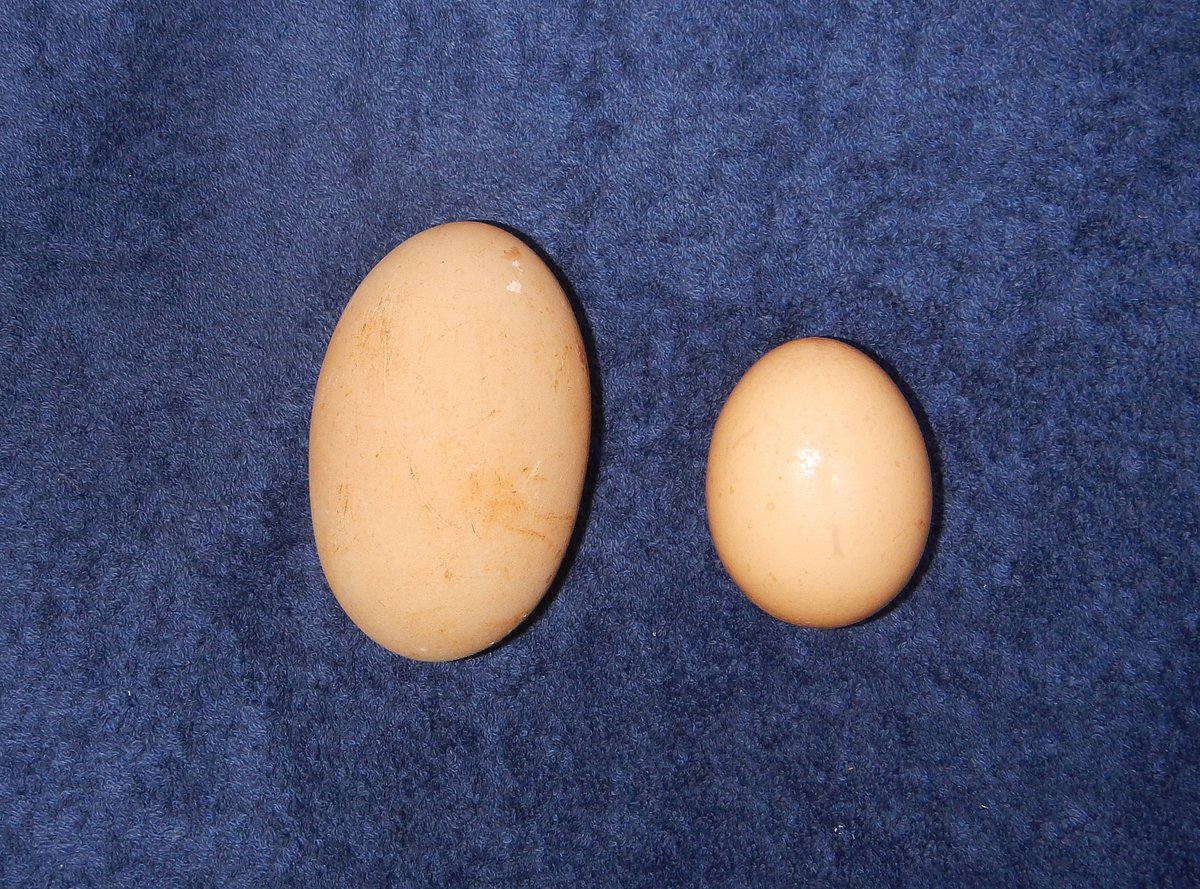
The islanders here are very used to trading for things. They are very isolated and trading is a way of obtaining hard-to-get items. Frank brought three lots of vegetables - one from himself, and the others from two ladies. He had papaya, plus some kind of yam and he also had a Bush Fowl egg, which is twice the size of an ordinary hen’s egg, so we took that as well. We ended up agreeing a bag of sugar, some sewing needles and soap for the ladies and for Frank we gave some Paracetemol, sandals and some clothes for his son. He says that he’s going to get four lobster for us tomorrow and would like some fishing line and hooks in return.
There was a nice sunset over the island and we’d just settled down for a quiet night, when a sailing canoe came into the anchorage and came alongside. The boat belongs to John who has a house on the beach near the anchorage, but at the moment, he’s staying over at Small Panasia and helping to catch a load of fish that they’re sending to Misima tomorrow.

They’d sailed over to say hello and to bring us four Painted Lobster that they'd just caught. We invited them on board and had a long chat. John says that he’ll be coming back to his house tomorrow afternoon and has suggested lots of things that he can help us with - it looks like we’ve got a new friend and guide.

The conversation drifted into what we have to trade. John was interested in clothes, fishing line, sugar, flour, files to sharpen machetes, sewing needles, etc . When I asked about what they wanted for the lobsters, they ummed and ahhed, muttering about clothes, soap and sugar - obviously thinking what their wives would ask for. I showed them a wind-up torch, their eyes lit up and there was no looking back - forget about things for the family, all three of them suddenly wanted this new toy. It was so funny - we gave them one each and they were very, very happy.
They left at eight o’clock to sail back to Small Panasia in the pitch dark, aided by their new torches - we could hear the whirring of the charging mechanism as they drifted off into the distance. We cooked the four lobsters, which Glenys served up with potato salad, papaya lime salad and tomatoes - very nice.
15 July 2015 Panasia, Papua New Guinea
It was a lovely day with blue skies and light winds, so we were doing pirouettes in the anchorage as the wind swirled around us. For breakfast, Glenys started to prepare fried Bush Fowl egg, but when she opened it, the egg contained a partly grown chick. Bush Fowl eggs are buried in the ground and the chicks emerge from the egg with all of their black feathers already grown, so the inside of this egg was horrible and went overboard very quickly - we had normal hen’s eggs for breakfast.
I started to get the dinghy into the water and, half way through, we were visited by three kids who had walked over the island from the village on the south shore. They brought some things to trade - papaya, coconut and a small pumpkin. We didn’t really need any of it, but Glenys took them anyway, giving them some clothes, exercise books and pens. They hung around watching me putting the outboard on the dinghy, so I took them out for a joy ride, which they loved - I’ll probably have a queue of kids around tomorrow wanting a go.
We dinghied out to Nasakoli Island, which is about 1½ miles across the lagoon. It’s a small deserted island with a beautiful white sand beach, which is good for shelling. When we arrived we found Frank sitting on the shore - he’d been out on the reef looking for lobster for us and had come to the island for a rest. We told him that John had delivered four lobster last night and we only needed two lobster from him, which he accepted with grace. He then walked around the beach with us, helping Glenys to look for shells.

Frank is a lovely bloke, but his smile is a bit scary because he’s a long term user of Betel-nut and his teeth are stained red. Everyone around here seems to chew this mild stimulant - I guess that it’s a habit like smoking. Here’s some information that I've gleened from various sources:
Betel-nut, the Areca Catechu seed, is used by virtually every adult in PNG as a pick-me-up during the day and the nuts take up half of the selling space in every market throughout PNG. Long term chewers get badly stained teeth - first red then black. The mild stimulant is brought about by the reaction of the Betel-nut, a Mustard Leaf and Lime Powder - and it tastes awful. Nuts can vary in potency and a strong one might cause you to sweat and want to lie down for a few minutes.
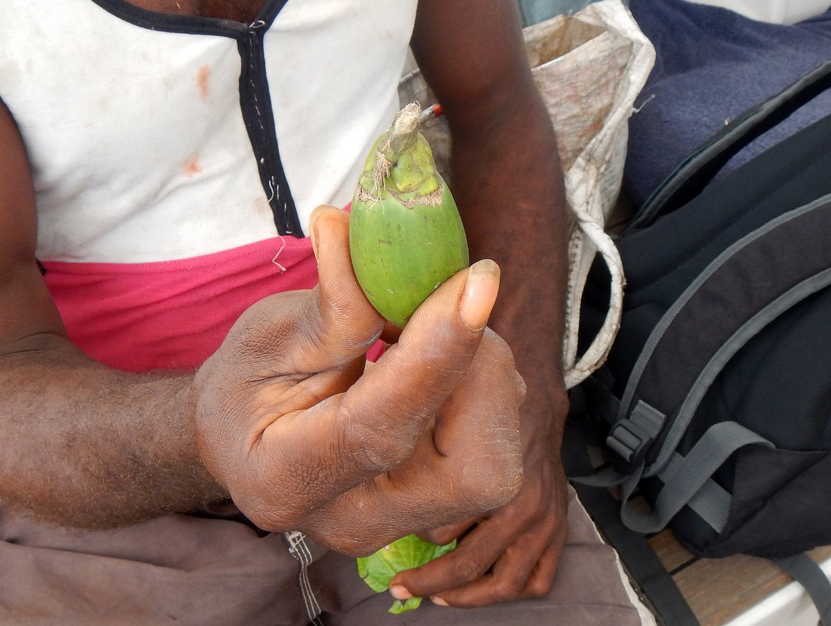
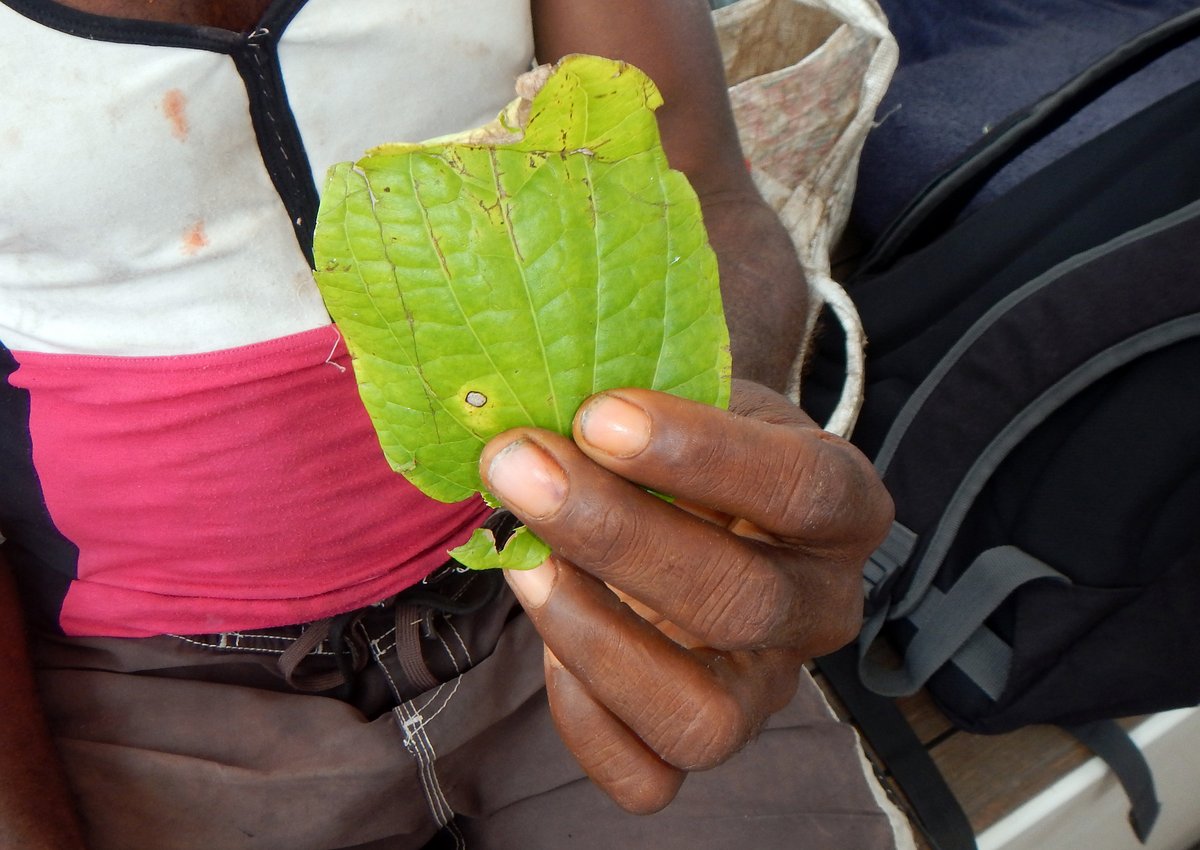

The lime powder is made from heating coral in a fire. It is also known as quicklime and is a caustic alkaline chemical called calcium oxide. When mixed with water (e.g. saliva), this turns into Calcium Hydroxide and is used in traditional building methods to make plaster, mortar and lime-wash (paint). Not surprisingly, this highly caustic powder causes damage to teeth, ulcerated cheeks and mouth cancers.
To partake, first take the husked nut between your back teeth and crack it near the stem. Prise it open with your finger, pluck out the kernel and chew it in your mouth to one side. You’ll suddenly be producing large amounts of colourless saliva - don’t swallow as you can get a bit nauseated, so find somewhere where you can spit.
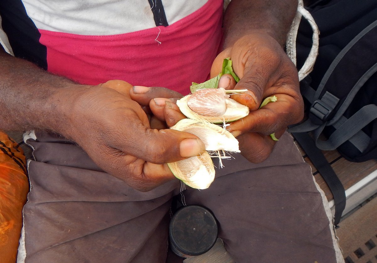
Next moisten one end of a rolled mustard leaf in your mouth and dip it into the lime powder so that a few millimetres are frosted with the lime. Bite off the Frosted Mustard Leaf in the back of your mouth, chew it all together and spit. Repeat, chew and spit.

This is when your projectiles will turn a vivid red and, with luck, you’ll feel the “rush” come on. It can sometimes be a little head-spin or it can be stronger - the effect will depend on your technique and you might be disappointed with your first try. Watch how others do it.
Seeing a foreigner eating Betel-nut “kaikai buai” will bring broad smiles across the faces of local people and you’ll immediately make friends. Be warned, however, that until you are practised, you’ll almost certainly make a mess as the voluminous red spit escapes your mouth, runs down your chin and ruins your favourite t-shirt.
I think that I’ll give this one a miss, but it's intriguing - who on earth thought of this combination? I imagine two guys meeting a few hundred years ago:
“Hey, you know that nut that you found the other day?”
“Yeah, tasted bloody awful and made us spit a lot.”
“Well, give it a try with some mustard leaf…”
“Wow man, that’s not too bad. Perhaps if we burnt some coral in a fire and ate the caustic white powder, it would turn our spit bright red and give us a mild hallucinogenic hit…”
On the way back to the boat, we stopped off to do some snorkelling, which was okay, but the water is still a little murky even in the middle of the lagoon.
Just after we’d got back to the boat, Frank paddled up with two lobsters for us, plus a couple of Nautilus shells - Glenys has been hankering after one of these for a year now, but refused to buy one from a tourist shop. He also brought us some more papaya and a yam. Frank said that one of the papayas was gathered by his son Michael, who wants a wind-up torch - it sounds like word has spread rapidly. We traded him a torch for his papaya, some fishing line and hooks for the lobster and a chopping board and knife for the other vegetables.

Glenys beavered away in the galley in the afternoon, making bread, cooking the two lobster and making Lobster Pizza for dinner. I went out and tried snorkelling in a different place, closer to the channel through the reef and found that it was more a interesting reef, but still had lots of sediment in the water.
Back at the boat, I checked the anchor and found that the chain had wrapped itself around a coral head. The two sets of fenders had then got tangled together and twisted around the chain as we spun around in the light winds. What a mess. I eventually had to cut one set of fenders away; dive down 12 metres to unhook the chain from the coral head and then pull up some anchor chain to re-attach the fenders.
John paddled over later in the afternoon, bringing his son and a nephew, plus half a dozen more Nautilus shells. Apparently, they are fairly common here and the guys find them floating on the surface of the sea as they paddle around. Glenys just HAD to have another two, so she’s now the proud owner of four Nautilus shells.
We dragged out some clothes so that John could choose something for the shells and he sorted through it, but couldn't make up his mind. He liked the look of three pairs of men’s shorts, a cutting board, a bag and a hat, but needed to choose which one. He was like the old analogy of the monkey with its fist in the cookie jar - he wanted it all, but couldn't get it.
As we chatted, John said that he wants to make us a wooden plaque with Alba carved on it and we asked for some bananas and green beans, so it was a perfect way for him to take the items that he wanted, without it looking unfair. We've arranged to scramble over to the village on the other side of the island tomorrow as long as the weather is fine and he’ll probably come with us.
16 July 2015 Panasia, Papua New Guinea
We had a restless night with huge gusts of wind hammering at our bimini and rain panels. The morning brought dark overcast skies and rain showers, so we hunkered down below.
Just as we were about to have lunch (Lobster sandwiches, of course), a couple of guys paddled up in their canoe. Sam is the pastor of Small Panasia and the brother-in-law of John; his friend was called Graham. We were more interested in having lunch than talking to the locals, so we chatted to them for a few minutes with them staying in their canoe. Eventually, Sam said that they’d come over to share a few stories, so we invited them on board and Glenys made some more sandwiches.

We chatted for a while and then Sam produced a necklace (which he’d got from his wife, presumably after hearing from Frank that Glenys was interested in local jewellery). This was made from Bagi - a type of red shell, which is highly prized in Papua New Guinea. In the past, there was a method of ceremonial trade between neighbouring islands where Bagi necklaces were used as a form of currency. In these ceremonies, prized gifts were exchanged as well as any surplus vegetables and fish. The necklace is made from 4mm diameter disks of Bagi shell, which have been hand filed and drilled to make beads. There are about 200 Bagi disks on this necklace, which is a lot of work.
Having shown us the necklace and Glenys saying that she would like it, the conversation turned to what would Sam like for it. After a moment’s thought, he said that he’d like my guitar, which he’d spotted hanging on the wall of our saloon. In your dreams! I explained that sorry, my guitar was not for trading. With a look of desperation, Sam kept saying things like it would be very good for his church to have a guitar and I kept saying no. I eventually told him that I would trade my wife, but not my guitar and that seemed to make the point…
Sam was then faced with the dilemma of what he wanted for the necklace. I brought out some bags of clothes and other things and he started to accumulate quite a pile until Glenys told him that he had to choose a few of the things not all of them. Ten minutes later, we had a deal for a small rucksack, a bolt of material, some thread and needles, some clothes, a bit of kitchenware and, of course, a wind-up torch.
Having agreed everything, we turned to Graham, who had brought some snake beans and a big bunch of cooking bananas. He managed to get away with more clothes and kitchenware, but no, we didn't have any more wind-up torches... I told them both to tell everyone that we had no more torches left.

Sam came here from Misima about fifteen years ago, specifically to dive for Sea Cucumbers, which the local people used to sell to Korea, where they are known as Beche de Mer. The locals don’t eat them, but were happy to gather them, dry them over a fire and export them. Unfortunately, the harvesting was too intense and the Papua New Guinea government stopped the collection of sea cucumbers seven years ago. Sam is waiting to be allowed to start again because it was a very useful source of hard cash.

We had a discussion about Betel-nut and both Sam and Graham said that they know that they should stop chewing it because it is ruining their teeth, but they can't live without it now. They chew about 20 Betel-nuts per day and also smoke a cigarette after every chew - a double addiction.
They were both carrying small bags, which contained their supply of Betel-nut and they showed us how to chew. (They promised not to spit red gloop on our boat.) At about one inch long, the nut kernels are surprisingly large. Sam showed us how they roll the mustard leaf and dip it in the lime powder - they consume quite a lot of the caustic quicklime and with 20 chews a day, I'm not surprised that they are ruining their teeth. I told them that they couldn't smoke on our boat, so they soon left with the urge to smoke a cigarette preying on their minds.
Twenty minutes after they left, Robinson (Frank's nephew) paddled up on Frank’s surf kayak. He’d brought some cooking bananas all the way from Small Panasia. We invited him on board for a chat and he said that the bananas were from his Bo-bo (elderly relative). He looked disappointed when Glenys told him that she didn't need any more bananas. I asked him what his Bo-bo would have wanted and, quick as a flash, he said … a wind-up torch. Like yeah, this old lady wants a wind-up torch. He looked crest-fallen when we said that we didn't have any more.
After fifteen minutes, we managed to politely evict Robinson, with a small gift of a t-shirt as compensation for our terrible lack of torches and thankfully returned to our own little world.
17 July 2015 Panasia, Papua New Guinea
We woke to strong gusts of wind and driving rain - a really horrible day. The forecast for tomorrow looks better, so we’re planning to leave and sail onto Port Moresby in the morning. It’s 365 miles, so we’re expecting to arrive there on Tuesday 21st, which hopefully, will give us time to get our Indonesian visas and leave before the end of next week - we need to be getting a move on to Indonesia.

In the evenings, I’ve been chatting to Karen on “Red Herring” using our SSB radio, but my transmission signal is very weak. I went through all of the connections for the antenna and the earth, which look okay as far as I can see and then I found that our antenna tuner was not operating.
After tracing all the wiring, I found a fault in the wire supplying the 12V power to the tuner. I crimped the wire and now I'm booming out a strong signal. In fact, the transmission signal is so powerful that all the LEDS on our switch panel flash when I speak. This can’t be good for our electrical systems, so I need to talk to a keen radio ham and find out what’s going on.
The skies brightened up a little in the afternoon, so went ashore to John’s house. We chatted to him for a while and then went for a walk along the shore line, looking for shells.
Back on the boat, we got ourselves ready for sea, tidying up and putting the dinghy on deck. John called by late in the afternoon and brought us a carving that he’s made for us for, a piece of Creosote wood. We've had a very interesting time here and the people have been very friendly - we wish that we could have stayed for longer than a few days.
18 July 2015 Panasia to Port Moresby, Papua New Guinea (Day 1)
The weather was much brighter this morning, but the skies were still overcast. The anchor came up without any problems, so the fenders on the chain did their job well. The light was poor but, we found a way through the reef and out into 2 metre waves and 25 knot winds - quite a shock after the relative calm of the anchorage.
Our route to the pass next to Uruba Reef was very hard on the wind, so we motor-sailed for three hours, only achieving 4 knots because we were constantly stopped by the large head-on waves. We cleared the pass by half past eleven and were finally able to ease the sheets a little. But it was still tough for a few hours because the wind was 25 knots at 60 degrees off our port bow.

As the afternoon progressed, the wind settled down to 15-20 knots and backed, so by sunset we were on a pleasant broad reach doing 6-7 knots. To get to Port Moresby, we’re following the south coast of Papua New Guinea, aiming to stay 20 miles offshore and, for some of the night, we picked up a favourable ½ - 1 knot current, which is pushing us along nicely. We have to sail 365 miles and if we get lucky with the current, and average 6.5 knots, then we might be able to make it with just 2 nights sailing.
Apart from dodging a few ships, the night was pleasant, but very, very dark with no moon - at least we’ll have a new moon when we do the next leg, after staying in Port Moresby for a few days.
19 July 2015 Panasia to Port Moresby, Papua New Guinea (Day 2)
There wasn't really a sunrise, just a gradual lessening of the darkness to give us a very grey morning with overcast skies. After I’d uploaded our passage blog posting and downloaded the weather, Glenys went to bed and left me to cope with the squalls that caught us up every hour - in some the wind picked up from 20 knots to 30 knots with heavy rain and others just gave us rain.
It cleared up in the afternoon, but the wind picked up a little to 20-25 knots and we had 3 metre waves making it a boisterous ride.
There’s quite a lot of shipping that is following our route, so we've been monitoring the AIS, which certainly makes our lives easier. Without AIS, when we spotted a ship, we’d have to figure out whether it was a danger to us. With AIS, we look on our chart plotter and it tells us the name of the ship, course, speed and Closest Point of Approach (CPA). If we’re not happy, we can call the ship up by name and discuss a plan of action.
Just before dark, I rigged up our spinnaker pole to port in anticipation of turning more downwind as we follow the coast line. It was a wild night. The wind wasn't too bad at 25-30 knots, but the waves were large and steep making the boat slew around and surf up to 10 knots. It was hard to relax when on-watch and very hard to sleep when off-watch.
20 July 2015 Panasia to Port Moresby, Papua New Guinea (Day 3)
Dawn was a little brighter than yesterday and the sun poked its head through the clouds occasionally during the morning. By eight o’clock, we’d done 170 miles in 24 hours - our best run ever. We only had 45 miles to go, so we looked forward to getting to Port Moresby in the late afternoon.
The wind continued at 20-25 knots from the SSE. We gybed the main as we turned the corner following the coast and then continued on a fast broad reach on starboard tack. We had a good angle to sail through Basilisk Passage and, once inside the barrier reef, had a lovely sail into Port Moresby in calm seas.

We arrived at the Royal Papuan Yacht Club Marina in the early afternoon and, as instructed, anchored behind their breakwater (which they call The Pond). The charts show a depth of 1.1 metres on the approach to the marina, but we saw nothing less than 4 metres. We weren't too happy about the holding in the Pond because we dragged the first time having picked up some plastic sheeting with our anchor, but other cruisers have been fine there.
The marina office arranged for customs, immigration and quarantine to come out to the boat, so we had our formalities completed and were safely docked in a marina berth within two hours. The only fees were $20USD for the animal and vegetable quarantine and $50USD for health quarantine.
After a little bit of tidying up, we strolled into the yacht club, which is huge. It's more like a country club for rich Papuans and ex-pats (3,000 members) with a nice restaurant, a huge bar and even a big gym. We used one of the two ATM machines to get some kina and retired to the bar for a cold beer or three.
At the marina office's suggestion, we called in at a big 50 foot power-catamaran called “Utopia” and talked to a guy called Brian. He turned out to be a 73 year old, white Papua New Guinean and an ex-cruiser having sailed 40,000 miles on his ketch “Duck Soup”. After plying us with wine, cheese and stories, Brian offered to get his driver to take us to the Indonesian Embassy tomorrow, which we gratefully accepted.
21 July 2015 Port Moresby, Papua New Guinea
Brian drove us to his company, which is the largest estate agent in Papua New Guinea, employing over 50 people - a wealthy man. From the office, we were driven around by Paul, one of Brian’s five sons, accompanied by Steve, who sailed with Brian and now looks after his boats.

Steve wanted to go to a vegetable market, so we accompanied him walking around the closely packed stalls. There are hundreds of thousands of people living in Port Moresby with over 80% unemployment, so there are a lot of people living in poverty and the city has a very bad reputation for hold-ups and theft. We're always very careful about our belongings when in local markets and we were especially careful here, but I didn't notice two rascals following us.
As we were the only white people (Dim dims) in the market, everyone was looking at us, so it was hard to for us to notice these two guys. However, the market stall holders spotted them and suddenly one stall holder leapt up and gave one of the rascals a huge slap around the head and started to scream at him. Within seconds, the rascal had twenty people haranguing him and he was chased out of the market. The stall holders all apologised to us, which was nice.
Paul then took us to a large computer store to buy a couple of things. On the way there we passed hundreds of people sitting on the sidewalks, in the dirt, with small selections of things for sale - limes, betel-nut, a few cigarettes. What a difference at the store, there were guards on the gate into the car park, guards on the door, guards inside the store. The store was huge with wall-to-wall high tech equipment, marble floors and air conditioning. There's an incredible difference in wealth here.
We were taken to the Indonesian Embassy, were we filled in a very straight-forward visa application form. We applied for a 60 day Social visa (211/60), which we can extend for another 30 days when we're in Indonesia. For each application, they wanted one photograph, one copy of a sponsorship letter, one copy of our Cruising permit (CAIT) and 120 kina ($40USD).
We told the visa officer that we wanted to leave Port Moresby on Friday 24th July. Thursday is a public holiday, so the guy said that he'd process it quickly for us and we could go back the next day.

Back at the boat, we had a couple of hours chilling out and sorting out emails then walked up a large supermarket, which is 10 minutes outside the secure fence of the Yacht club. It's bizarre to walk out of the decadent luxury of the Yacht Club onto the streets where the locals are trying to sell stuff or waiting for a bus and chewing betel-nut. There are betel-nut husks scattered around everywhere and the white concrete pavements are covered in blobs of bright red spit - it's disgusting.
The government is trying to stop the habit and has made it illegal to chew and spit in public places within the city limits. There are signs on the shops and gates into private businesses - "No chewing betel-nut", but the poor locals just ignore it all. I guess that it's as addictive as smoking, so will be difficult to stop. Brian hates the habit and forces his employees to brush their teeth on arrival at his office.
In the evening, we retired to the luxurious Yacht Club bar and had a few beers with Rob and Irene from “Peggy West”. They are also heading off to Indonesia to join the Sail Indonesia rally.
22 July 2015 Port Moresby, Papua New Guinea
Today was chore day. Glenys spent most of the morning running backwards and forwards to the marina's laundrette. Meanwhile, I tackled the problem of getting fuel. There's a fuel dock in the marina with automated pumps, which take non-refundable, pre-paid fuel cards. This is a great solution for the regular members, but I wanted to fill up my tank and jerry cans and didn't know exactly how much fuel I would need.
I estimated that I'd need 200 litres of fuel, which would cost 600 kina ($180US), so I played cautious and bought 5 * 100 kina cards. We motored over to the fuel dock and, unfortunately, I could only squeeze 400 kina worth into my tank, so I'm left with a non-refundable 100 kina card ($30USD) - bummer! I gave it to Brian as a thank you for driving us around.

In the afternoon, we cadged a lift from Brian into the Indonesian Embassy and picked up our passports with our 60 day visas and then went to the supermarket to do a big two trolley re-provisioning. We caught a taxi back to the yacht club, dumped the shopping on board and retired to the bar for beers and a bar meal. We're planning to leave on the 24th for our 1,100 mile passage through the Torres Straits to Indonesia.
23 July 2015 Port Moresby, Papua New Guinea
It was a public holiday today. The boat looked like a bomb had hit it with provisions all over the place, but we left it all there and went out for a day trip on "Utopia". Brian had also invited "Peggy West" and an ex-pat couple called Ernie and Lorraine.
"Utopia" is a 50 foot catamaran with two big engines, which will do over 15 knots in calm seas. It's quite bizarre screaming along at those speeds with nothing tied down. Brian took us for a tour around the harbour, which is a large, deep, natural port which housed the whole of the American Pacific Fleet during the Second World War.
There are the semi-sunken remains of a warship and ruined Army buildings in the harbour, with large areas outside the harbour that are dangerous because of it was a former mined area and there may still be unexploded ordnance on the sea bed.
After our jaunt around the harbour, we headed out to Manubada Island, which is a favourite haunt of the Yacht Club members. It's only 5 miles from the marina, but is a pleasant little island with a white sand beach. There were three large traditional, Papuan barges on the beach.
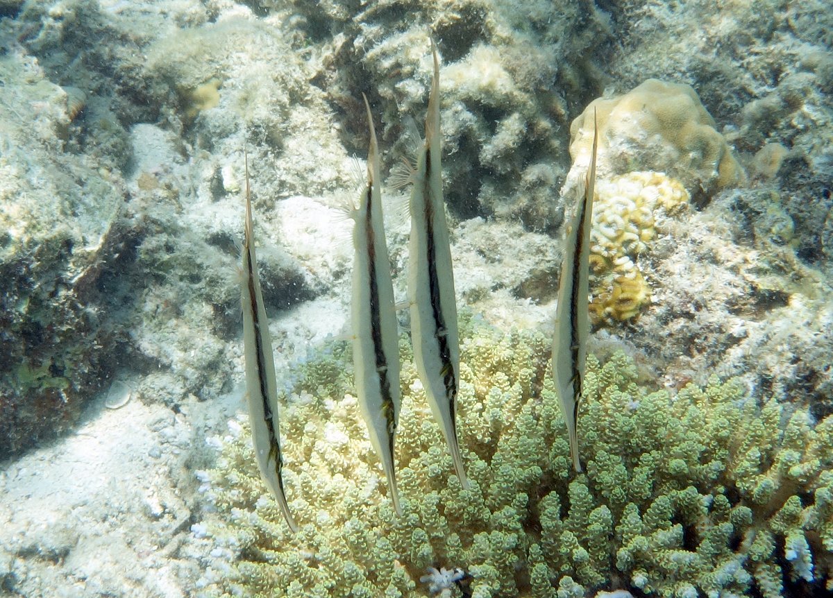
Glenys and I went snorkelling for an hour, but the water was disappointingly murky, but I saw some Razorfish - strange thin fish that hang about vertically with their heads down. We had a boozy lunch, chilled out then whizzed back to the marina. Nice day out.
24 July 2015 Papua New Guinea to Tual, Indonesia (Day 1)
Sailors tend to be very superstitious and a few people told me that we shouldn't leave on a Friday. I'm not particularly superstitious, apart from knocking on wood three times if I say something that the gods could use against me - like "at least there's no lightning in this squall". So, I ignored the warnings and we left on Friday.

The day didn't start too well. Customs and Immigration said that they'd come to the marina between eight and nine o'clock to clear us out, but didn't show up until half past eleven; and then only after three "reminder" telephone calls from the marina office. We were ready to cast off our ropes at nine o'clock, so by the time that they arrived, I was sick to death of waiting around.
We finally managed to get away by midday. As we backed out of the berth, I noticed the sound of cavitation on the propeller, but ignored it assuming that I'd only heard it because the water in the marina was so calm. We motored across to the reef passage and out into a very pleasant 15 knot south-east wind putting us on a nice broad reach.
The sun was shining and all was well, so at two o'clock, I had a shower and went to bed. We always leave our engine gearbox in neutral when sailing, which means that the propeller shaft is constantly rotating, making a whirring sound that I can hear when in bed. It's actually a very useful indication of our speed through the water.
As I lay in bed, something didn't sound right, but I tried to ignore it to get some sleep. After 30 minutes, I'd decided that there was something wrong with the propeller - was it loose and slowly un-screwing, was the zinc coming loose causing imbalance? With a deep sigh, I climbed out of bed to investigate. Everything looked okay in the engine room, so the only thing to do was to stop sailing while I snorkelled under the boat.
We hove-to, but by this time, we had 2 metre waves and 20 knot winds, so we were moving too fast through the water. We rolled away the sails and lay a-hull, which was better, but we were still pitching and rolling alarmingly in the steep waves.
I put on my snorkelling gear and tentatively jumped in, grabbing the swim ladder to make sure that I wasn't swept away. The stern of the boat was rising three feet in the air and crashing down making it very hazardous.
I couldn't see the propeller from the swim ladder, so I took a deep breath and dived down to find a length of one inch diameter polypropylene (floating) rope wrapped tightly around the propeller. Glenys carefully passed me a bread knife and it took me ten minutes to cut the rope free, constantly battling against the movement of the boat and being careful avoid our 12 ton boat crashing down on my head.
Back on board, I had another shower and went to bed again. I lay there thinking that's two unlucky things - delayed clearance and a fouled propeller. Now highly superstitious, I was wondering what else was going to happen - bad things always come in threes.
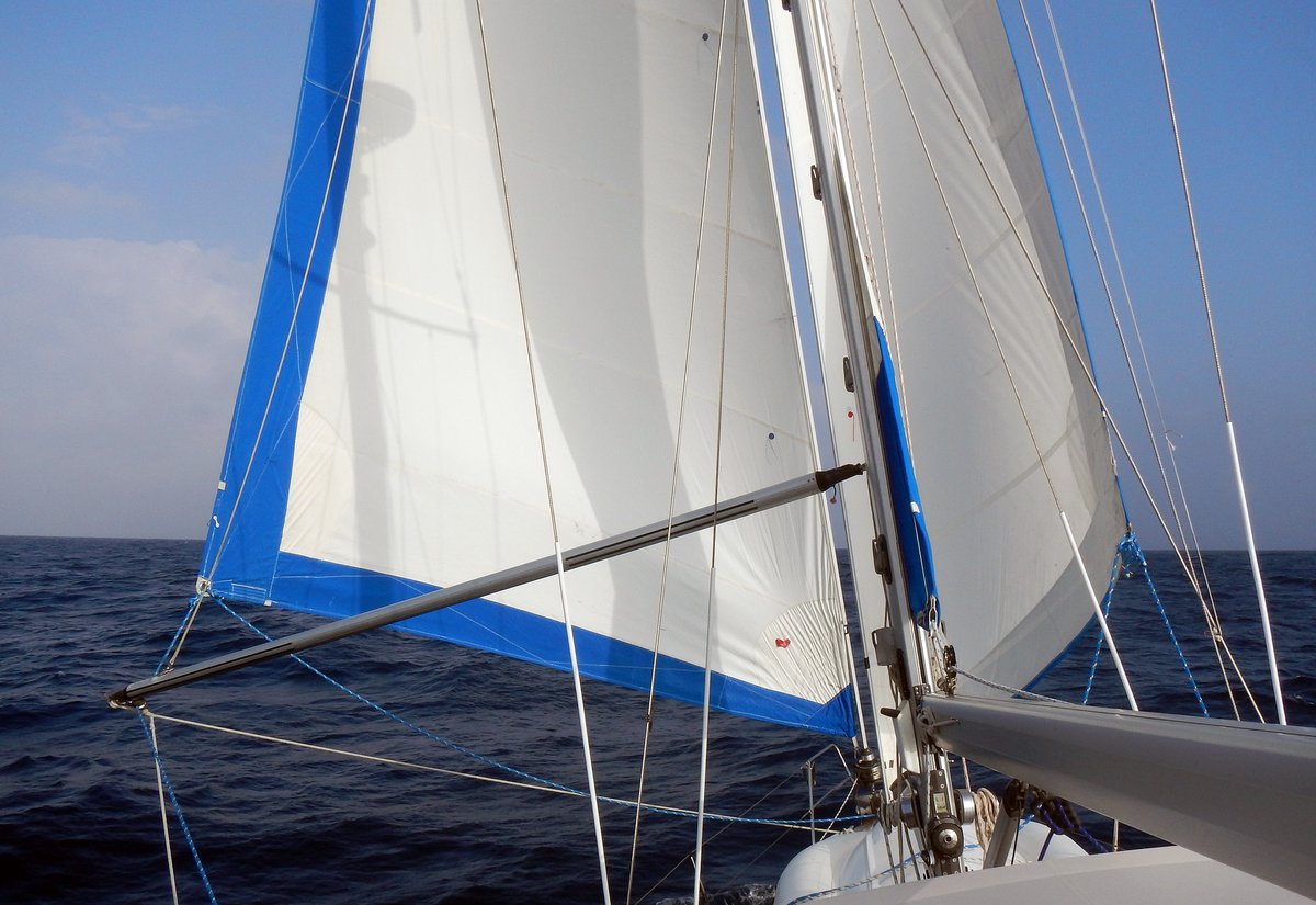
It’s a bit frustrating that we had the rope around the propeller. We used to have a Rope Stripper on the propeller shaft, which has three very sharp blades that rotate and should cut rope before it gets wrapped around the propeller. However, it was worn out and rattling all the time, so I removed it in New Zealand and never got around to repairing it.
Over the past two weeks, I’ve been trying to arrange for some spare parts to be sent out to Darwin, where “Spruce” had said that they would bring them out to Indonesia for us. Unfortunately, the guy who runs Ambassador Marine, who makes the Rope Stripper, has been away on holiday and he replied to my emails too late for the parts to be sent out to Darwin before the rally leaves there tomorrow. I’m not sure where to get the parts sent to now. Indonesia and Malaysia are renowned for having lots of junk (including rope) floating in the water, so I’ll be keeping my fingers crossed that we don’t pick up any more on our propeller.
By the time that I got up at five o'clock, the wind had picked up to 25-30 knots and the seas were very unsettled with 3 metre waves. Glenys had already reefed the genoa and main, but with night approaching, I put a deeper reef in the main. By eight o'clock, the wind had dropped to 15-20 knots and was slowly backing, making the genoa flog as the mainsail took its wind.
I spent a very unpleasant thirty minutes, hanging on to the rolling boat, rigging the spinnaker pole to port. At night, when Glenys is in bed, I always wear a harness when working on the foredeck, which is a damn nuisance because the safety line is always getting caught or getting in the way, so it took twice as long as normal. By the time that I'd finished, the wind had backed a further ten degrees and there were ominous flashes of lightning behind us, so I rolled away the main sail and we ran downwind with just the genoa.
The next hour was both frustrating and scary. The wind continued to back - it went from south-east to north. The lightning got brighter and then it started to rain. Not heavy, but persistent. The wind swirled around, but stayed light, so we were down to 3 knots boat speed and rocking and rolling in the confused seas. Glenys got up to find out what was going on.
A huge bolt of forked lightning blazed down from the sky. We started counting out the seconds, getting to sixteen before a massive peal of thunder shook us both into activity - only four miles away. Glenys grabbed the iPad and I grabbed the satellite phone, shoving both into the oven, which theoretically acts as a Faraday Cage - we hope this will protect anything electrical inside if we have a direct lightning strike.
The lightning seemed to be north of us, so I headed south, guessing that the storm was heading downwind in a north-west direction. It was frustratingly slow trying to sail away and we seemed to be trapped in the middle of the weird winds. Eventually, the wind veered, quickly coming around to south-east again, but dropping off even more.

By the time that Glenys got up again at ten o'clock, I was motoring and the lightning had thankfully gone away. One hour later, the wind had picked up to 15-20 knots and Glenys was able to sail again. The rest of the night (Saturday) was lovely, drifting along at 4-5 knots on a broad reach.
25 July 2015 Papua New Guinea to Tual, Indonesia (Day 2)
The skies were overcast at dawn, but it soon brightened up. The wind was 20 knots from the south-east, so we poled the genoa out to port, pulled the staysail out to starboard and rolled off downwind at 6 knots.
The weather stayed consistent all day and we had a very restful time, catching up on sleep and getting back into the rhythm of life at sea. In the late afternoon, we rolled away the staysail and pulled out the main sail in preparation for turning more upwind tonight.
By sunset, we were passing the northern tip of the Australian Great Barrier Reef and entered the shipping lanes for the Torres Straits, which is one of the longest shipping lanes in the world, weaving its way through coral reefs and islands between northern Australia and Papua New Guinea. The Torres Strait is 150 miles long, so it's going to take us about 24 hours of careful navigation and good lookout to get through.
As we transit the Straits, we'll be moving from the Coral Sea to the Arafura Sea. These are both part of the Pacific Ocean, but are totally separate tidal basins, which means that they have different tides making it difficult to predict currents. In addition, the Coral Sea is usually up to ½ metre higher than the Arafura Sea, so there's a steady flow of water heading westwards.
It's far too complicated to try to work out the overall currents at any place, so all we can do is go for it and hope that we'll be lucky, because there can be up to six knots of current, which if it's against us would stop us dead in our tracks.

We'll be passing very close to numerous small islands that belong to Australia and there are places that we could anchor if the current or the stress gets too much for us. However, we won't be able to go ashore without going through the complicated and expensive clearance processes (which is why we're not visiting Australia).
By 2200, we had 25-30 knots of wind from the south-east and we were down to two reefs in the main and just the staysail. Our course along the shipping lane was 220 degrees, putting the wind just in front of the beam - it was a bumpy ride and very dark once the moon disappeared at 0100.
The shipping lane varies between one and two miles wide and passes within one mile of multiple reefs and small islands. Thank God for GPS, electronic charts and AIS - I wouldn't like to do this passage using dead reckoning and paper charts, because the lighthouses are few and far between.
We elected to hug one side of the shipping lane, reasoning that the big ships would want to be more in the centre. In the event, there wasn't too much shipping about. By dawn, we'd only seen one cargo ship, a fishing boat, a pilot boat and a tanker.
26 July 2015 Papua New Guinea to Tual, Indonesia (Day 3)
At daybreak, we still had 25-30 knots of wind, but it had veered by 20 degrees. In addition, the shipping channel forced us onto a course of 210 degrees - putting us fairly hard on the wind. We needed to charge the batteries, so we turned the engine on and motor-sailed for four hours - reefing the sails and making the motion more comfortable.
By midday, the shipping lane had turned more westerly, allowing us to ease the sheets onto a broad reach. As we progressed through the Straits, the wave height decreased and the sailing was lovely. The sea is very shallow, mostly around 20 metres, so with the blue skies, the water was a pleasant blue colour.

It was our 35th wedding anniversary today, but we didn't do anything special - just enjoyed the sailing.
In the late afternoon, we entered the Prince of Wales channel, which skirts a cluster of eight islands including Thursday Island - the most northern port of Australia. We sailed within 250 metres of Hammond Island, going inshore of the light on Hammond Rock. It's very strange to be passing so close to Australia and not stopping - if only their clearance procedures weren't so onerous.
Despite my earlier concerns about the currents through the Torres Straits, we experienced very little at the eastern and central parts and picked up a favourable 1.5 knot current in the Prince of Wales Channel. I'm not sure whether this is normal or we were just lucky.
Similarly, the shipping wasn't a major problem. By sunset, we'd passed only three ships, but after dark, there was a gaggle of them coming into the western end. They caused us to alter course a few times and, at one point, scurry across the shipping lane between the traffic.
We left the shipping lanes of the Straits at 2100, but still had another 25 miles before we were clear of patches of shallow reef. We were then able to set a course of 285 degrees, heading on a broad reach for Indonesia. The moon was out until two o'clock in the morning, the seas were less than a metre, the wind was 15-20 knots and we had a lovely night. I really enjoyed sailing through the Torres Straits.
27 July 2015 Papua New Guinea to Tual, Indonesia (Day 4)
The morning started off overcast, but soon turned into a nice, sunny day. The wind was consistent at 18-22 knots and we poled the genoa out to port running on a very broad reach. The waves started to build up a bit, causing us to surf at up to 9 knots at times and we began to roll more often. However, it's not as bad as the east side of the Torres Straits.
Glenys used up the last of her pressure-cooked stew last night, so I was allowed to fish and within two hours had hauled in a nice 3 foot Blackfin Tuna. I bled it to stop the meat being too red. This entailed making a slit in the flesh behind each pectoral fin to cut the main artery along the spine; slitting the lower part of both gills; tying a rope around the tail and then dropping the fish back into the water for ten minutes ... then praying that a shark didn't come along.


I filleted the fish on the bucking aft deck and Glenys then split the fish into five meals, vacuum packing four lots and leaving enough for dinner and some lunches. We had fried fish butties for lunch, of course.
We had a glorious afternoon and night brought us a ¾ moon and clear skies. The wind picked up a little to 20-25 knots and backed 20 degrees, so we rolled downwind at 6-7 knots all night. We also had a favourable ½ to 1 knot current, so we made very good progress.
We put the clocks back an hour, so we both got an extra 30 minutes in bed - luxury! On my 1-4 watch, I encountered a small fleet of ten fishing boats, which fortunately were well lit and moving slowly, so were easy to avoid.
28 July 2015 Papua New Guinea to Tual, Indonesia (Day 5)
It was another gorgeous day, screaming downwind at 6-8 knots. The seas are steadily getting bigger and the endless rolling is starting to get very wearing, but we're making good time - 165 miles in the last 24 hours, which is an average of 7 knots.
Once again the days are becoming a blur - just a series of watches and sleeping, interspersed by meals. Glenys made some Banana Bread today which will be very welcome on the night watches.
I've received an email from "Spruce" telling me that the scheduled events for the Sail Indonesia rally are all now happening a week earlier than was published on the Sail Indonesia website. The rally started in Darwin last weekend and there were some presentations about the events, but I have no details about them. I've emailed the organisers to try to find out more.
Top of our list is an event in Pasar Wajo in Buton, where last year the town put on a spectacular event with 20,000 dancers. I think that this is going to take place again sometime around the 18th August, so that's our target. When we get to Tual in three days' time, we'll probably just stay overnight and then move on - it's nearly 700 miles from Tual to Buton, so we haven't got a lot of time. I hate rushing through an area like this, but we should be able to slow down when we get to Buton.
Most of the night was lovely with clear skies and a bright moon. However, at three o'clock, a squall system sneaked up on me just after I'd made a 20 degree course change to starboard. Using our radar, I could see that the system was to our right, so I had to change back to our original course to allow it go past. The edge of it just clipped us and gave 35 knots for five minutes. Then I had to wait fifteen minutes for the wind direction to settle down before making my course correction and gybing the main. The rest of the night was clear.

29 July 2015 Papua New Guinea to Tual, Indonesia (Day 6)
At 0800, we'd done 775 miles with 250 to go. For the past two days, we've averaged 7 knots, so there was an outside chance that we'd arrive by sunset tomorrow, which was very encouraging.
We had another glorious day. Our course is turning slightly more north as we approach Tual (skirting around another large island group called Pulau Koba), so we swapped the pole over to starboard and gybed the genoa. The wind stayed at SE20 and we had very handy 1-2 knot current with us all day, pushing us along at 7-9 knots over the ground.
I received an email from the Sail Indonesia rally, which gives us more information and confirms that we need to keep pushing on. We were planning to meet the rally in a place called Wangi Wangi around the 14th August, but the anchorage is only suitable for 10-12 boats and our rally has over 40. To make matters worse, there's another rally (Sail2Indonesia) with another 50 boats scheduled to arrive on the 15th - it will be ugly with 80 boats jostling for space, so I think that we'll give that place a miss and join the rally at the next stop, which is Pasar Wajo, Buton.
The wind dropped a little in the afternoon, reducing our speed over the ground to a mere 6-8 knots, so it was looking unlikely that we would make it to Tual before dark tomorrow. The city of Tual is at the northern end of the Kai Islands, so I spent a few hours researching possible places to anchor around the southern end of the island group. Stopping at one of these anchorages would shave 30 or 40 miles off our passage and hopefully allow us to make landfall before dark tomorrow.
Just after sunset, on my 7-10 watch, a fleet of fishing boats suddenly appeared in front and to the starboard of us. Their strong lights could be seen looming over the horizon. They don't show up very well on our radar, so all I could do was to keep on our course and sail through the middle of them.
One of the fishing boats came to have a look at me, passing within 200 metres. The boat was lit by twenty or so very bright lights and I think that it was trawling a net because it was motoring at less than five knots. I can't be sure be sure though, because its lights were blinding me. The Arafura Sea is very shallow - we've been in 30-100 metres for the past three days since we left the Torres Straits, so I guess that it's a good area for trawling.
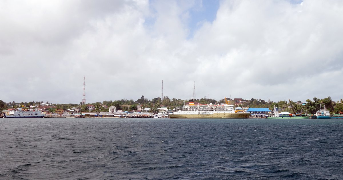
At our change of watch at 0100, Glenys gave out a little cry of astonishment when she saw that we were surrounded by thirty fishing boats. Fortunately for her, the fleet all disappeared behind us within an hour. The rest of the night was lovely, with a full moon, but we lost our favourable current.
30 July 2015 Papua New Guinea to Tual, Indonesia (Day 7)
We spotted land at ten o'clock in the morning, when we were 10 miles from the south end of the Kai Islands. We still had over 50 miles to sail between two islands and then into the large Tual harbour. This meant that we would be anchoring in the dark, but Tual is a large commercial port, so we hoped that the charts and buoys would be accurate. We decided to go for it.
The morning remained pleasant with SE 20 winds, but he winds and seas increased as we approached the southern headland of the islands. Once past the headland, we were in a 5 mile wide channel between two islands and the winds became very gusty - one minute we had 10 knots, the next 25 knots. It was very frustrating because we were under time-pressure to get there before dark, so we motored for a couple of hours. The wind returned briefly, but after an hour of sailing, we had to put the engine on again - then off, then on, then off, then on …
We motored in to the main harbour just after dark, so we were anxious to find a home for the night. Unfortunately, as we rounded a major buoy, we discovered that the Navionics charts are out by ½ mile (the chart is 0.4 miles from the GPS position on a heading of 225 degrees). This makes it a little difficult to navigate in the dark, especially as there are plenty of shallow reefs and seaweed farms around to add to the challenge.
Fortunately, our friends on “Red Herring” had given us the GPS coordinates of where they anchored, so we headed for there and dropped the hook at 05°36.67S 132°44.43E in 15m of water, just outside a sea-weed farm. It seems to be good holding.
We cracked open a celebratory cold beer and listened to the sound of the multiple mosques calling the faithful to prayer. We’re in Indonesia.
31 July 2015 Tual, Indonesia
We had a fabulous night’s sleep. After breakfast, we went closer to town, dropping the anchor at 05°38.04S 132°44.20E in 15 metres of water. It’s at the edge of yet another seaweed farm, which is a mass of small plastic bottles, which appear to be holding up lines where the sea weed grows - I need to investigate this some more.

After I’d lifted the dinghy off the front deck, we went across the harbour and tied up to the Coastguard dock (05 37.97 S 132 44.55 E). Everyone was very friendly with big smiles and there was no problem with us being there.
We walked out of the port into a sensory-overload of colour, smells and noise. I don’t think that they get a lot of white people (“Orang Bule”) here, so we were the centre of attention – it was very unsettling with people shouting things at us as we walked past, probably being friendly and trying to say hello, but not understanding a single word of Indonesian, I don’t know.
We were approached by a guy called Tukan, who had a nice car and offered to take us around. We thanked him, but said that we wanted to walk. One block away from the port, we found an ATM opposite a small mosque, but couldn’t get any cash out with either our Visa or Mastercard. A guy pointed us up the road to a bank, but we could get anything out of their ATM either.
No problem, I had $100US with me, so we’d go into the bank to exchange it. No chance. One of the guards spoke a little English and seemed to tell us that no bank in Tual would exchange any currency. Yikes … what do we do if we can’t get any money?
We decided to walk up to Immigration, where we’d heard that one of the ladies spoke really good English, but got a bit lost. While we were dithering about looking confused, Tukan pulled up alongside us (he must have been following us) and offered his help again. This time, with no cash and very anxious, we agreed to let him drive is around. Tukan speaks some English, but 50% of the time he didn’t understand us and 50% of the time we didn’t understand him, so there was a lot of smiling and nodding of heads.
Tukan took us to Immigration, who said that we need to first go to Quarantine. Okay. Back in Tukan’s car, we explained that first we needed to get some cash and our cards didn’t work in an ATM. Is there somewhere that we exchange some dollars? Tukan said knew a Chinese guy who changed money.

We drove across a bridge to the nearby town of Langur. Tukan stopped on the side of the road and started to lead us down a scruffy alley towards industrial warehouses. Errr… Should we be doing this? We followed because we had no other way of getting cash.
Tukan stopped at a warehouse door and walked into the gloom, speaking to some guys as he passed by. We were surrounded and waited. A young Chinese guy appeared and, with lots of smiles, exchanged $70US for 875,000 Rupiah. They were all so friendly, even posing for a picture.
Having obtained some cash and escaped a perceived robbery, we felt a little more relaxed. Tukan took us to the Quarantine office, who were very nice and spoke a little English. They didn’t charge us anything. We said that we wanted to leave Tual for Banda tomorrow morning and they gave us two certificates - one for the clearance into Tual and another for clearance to Banda. It’s a bit weird getting quarantine to another port, but I just thanked them and moved on.
We headed back to Immigration, who were lovely - very polite, no fees and lots of smiles - even playing us some Adele on their computer. Again we asked for clearance to go to Banda tomorrow morning, which was no problem. They said that we had to go to customs next and spoke to Tukan in Indonesian.
Tukan took us to an office right next to the Coastguard, where they spoke less English, but were friendly and gave us a very official looking document clearing us to Bintan, which is the last island before we leave Indonesia in three months’ time. I asked if that was everything finished and they said yes, so we left.
Back at his car, Tukan asked for 200 for his petrol. I was very confused, looking through my wallet at notes with denominations of 10,000 and 20,000. Eventually, I realised that he was asking for 200,000 rupiah ($20USD) and let him pick four 50,000 rupiah notes out of my wallet. It was probably a very good deal for him, but a bargain for us after two hours of driving around and his assistance.
Before we let Tukan go, we asked him to take us to get some SIM cards for our phone and iPad. Nobody in the shop spoke English and Tukan wasn’t very technical, so it took twenty minutes to get two SIM cards for $13US. Later on, we discovered that the iPad connected to the Internet okay, but we had no call time on the phone. Why on earth they didn’t sell me some airtime minutes, I don’t know.

After three hours, totally exhausted - mentally, emotionally and physically, we parted company with Tukan and escaped back to Alba for lunch. Our anchorage opposite the town was noisy with the sound of motor bikes and the (seemingly) constant calls to prayer, so we headed back up the harbour to a more peaceful spot. We anchored a little south of last night’s anchorage and a little more out of the shipping channel at 05:36.82S 132:44.45E.
We had lunch and chilled out. Glenys had a nap, but I couldn’t settle - something was nagging at the back of my mind. None of the officials had asked how much alcohol or tobacco we had on board - in fact, we’d not been asked any of the usual customs questions and no one had asked for our customs clearance from the last port.
At three o’clock, I cracked up, jumped in the dinghy and went the mile or so back into town to check whether we’d completed the clearance. It turned out that the office that Tukan thought was customs was the Port Captain and yes, we needed to see customs as well - I obviously asked the wrong questions this morning.
As I walked out of the Port Captain’s office, my mate Tukan was lurking about and said that he’d take me up to customs for no money because he was happy with me. OK - I’ve obviously paid him too much.
The customs were great. It took over 30 minutes to sort out my paperwork, but I spent the time chatting to four officers (and Tukan) about snorkelling, England, smoking, alcohol and other blokey, blokey stuff. Two officers wanted to come out to do an inspection of the boat, so Tukan dropped us off at my dinghy. Tukan wanted to come with us, but I stopped him because I knew that we wouldn’t be able to plane with four people - I feel really bad about it now. No doubt he would have enjoyed visiting a yacht - I’ll make sure that we invite more people on board as we continue through Indonesia.
The customs guys were wonderful and their inspection was very relaxed. They took photos of random lockers and our medical kit, as well as asking questions about alcohol, tobacco and drugs. Interestingly, they said that if we had beer that was over 5% then they would put it under customs seal until we leave the country, but in moderation, wine at 12% and rum at 40% is OK. Before they left, they wanted to take “selfie” photographs of themselves and us on our foredeck.
I dropped the customs guys back at the Coastguard dock, where Tukan (bless him) was waiting to take them back to their office. I said goodbye to Tukan, once again regretting that I didn’t bring him out to our boat.
Back at the boat, I put the dinghy on deck and then collapsed with a cold beer as the sun went down, waving to the friendly locals coming to have a look at us and listening to the mosques starting their mournful chants calling the faithful to prayer.