1 February 2019 Boqueron to Mayaguana, Bahamas (Day 2)
Dawn brought us blue skies with fluffy, white trade-wind clouds and a consistent 20 knot winds on our starboard quarter. Our 24 hour run was 140 miles, which is a good start and leaves us 300 miles to go. Touchwood, we should be there by midday on the day after tomorrow.

I often say that sailing is the unpleasant bit between anchorages, but today was glorious – blue skies, sparkling seas, running on a broad reach with 20 knots of wind behind us.
We had 6 foot seas, which made us roll, but it was a motion that we could live with. A pod of dolphins briefly joined us, but were soon on their way doing dolphin things. The only disappointment today was the fishing. Despite towing a new blue lure all day, with very little Sargassum weed, we caught nothing.
The good weather continued into the night, with very little cloud and consistent winds, so we continued bowling along beneath the twinkling stars.
2 February 2019 Boqueron to Mayaguana, Bahamas (Day 3)
We had another nice morning with steady east 18 knot winds. Yesterday, we did 150 miles and with 150 miles to go, we should be arriving tomorrow morning, which will be perfect. I downloaded a weather forecast and the wind looks to remain easterly, dropping down to south 5-10 knots on Monday 4th.
The stalled front is still hanging about over the central Bahamas, but it should start dissipating tomorrow. It looks like another front is forming and will head down to the central Bahamas on the 6th, so we’ll probably have north to north-east winds after the 6th.
There wasn’t much Sargassum Weed about, so I put out two fishing lines, adding a red lure to the blue one. I hooked two fish on the red one - the first one was a nice 6-8 lb Dorado, but it jumped off the hook when I was trying to gaff it. The second fish was a 4 foot long Barracuda, which I had to release. After that there was too much weed to continue – I’m kicking myself about losing the Dorado.

The fabulous weather continued into the night and, at our 01:00 watch change, we only had 40 miles to go. We were romping along at six knots (with a heavily reefed main and genoa) and we had an ETA of about 07:30. The entrance through the reef is directly into the rising sun and there are lots of shallow reefs on the route to the nearest anchorage, so we don’t really want to attempt it until after 10:00. I rolled the main away and we plodded along on a heavily reefed genoa still doing about 4 knots.
3 February 2019 Boqueron to Mayaguana, Bahamas (Day 4)
At dawn, we were only 10 miles away, so we reefed the genoa down to a handkerchief, but we were still doing 3-4 knots over the ground. We arrived off the west entrance to Abraham’s Bay at 08:00 with the sun very low in the sky. In my infinite wisdom, I decided that it would be okay to go through the pass because we would be heading north-east, slightly off the direct line of the sun.
Big Mistake. We easily made it through the pass into the bay, but we still had at least 1½ miles to go before we could anchor. There are numerous shallow coral patches scattered around the bay and the route to our planned anchorage was directly into the sun. I stood on the bow, straining to look into the glare and Glenys was at the helm, stressing out because we were moving so slowly that the GPS was getting confused.
To make matters worse, the 20 knot east wind was kicking up 2 foot waves and small clouds were scudding overhead, casting dark shadows on the sea bed that may or may not have been patches of coral. Close to the pass, the sea bed is mostly coral and, with crystal clear water, and the depth of only 5 meters, it looks a lot shallower.

Eventually, we found a place that we thought was sand and decided to drop the anchor to wait for the sun to get higher in the sky. The gods weren’t on our side and the anchor wouldn’t hold, so we carried on, heading north-east until we arrived at a place where the chart says “good holding in clear sand”. At 09:00, we dropped the anchor at 22°19.92N 73°01.47W in 4.5 metres of depth. I donned my snorkelling gear and confirmed that the anchor was indeed well buried in “good holding white sand”. We’ve been sailing in Tropical waters for 8 years - what was I thinking entering a reef system directly into the sun?
Anyway, it was a good passage. Apart from having to motor up the coast of Puerto Rico for three hours, we sailed most of the way and did the 440 miles in 3 days and 3 hours, which is an average of 5.9 knots. We can take things a little easier now because we have a month to travel 150 miles to meet our son, Craig in Georgetown in five weeks’ time.
After lunch (when the sun was high in the sky), we moved closer to the settlement. Abrahams Bay is 5 miles long and gradually gets shallower and shallower as you head east. We skirted around a few shallow coral patches and kept a wary eye on the depth sounder. Our bottle went when we had a depth of 2.7 metres, so we dropped the anchor at 22°21.40N 072°59.41W. We’re over a mile from the shore, but happy enough.
4 February 2019 Abraham’s Bay, Mayaguana, Bahamas
After breakfast, we went ashore to clear in. There’s an old concrete dock with a 5 metre wide channel, which thankfully is deep enough for a dinghy at any state of tide – leave the pole markers to starboard. We found the customs building underneath the telecom tower.
Clearing in was a doddle – everything was handled by one lady. All I had to do was fill in five forms and hand over $300US. In return, I received a cruising permit for 12 months, a three month immigration visa and a fishing license. As usual, our next stop was to buy a SIM card and an Internet data package. It cost $40US for 1 month, but we get 15 Gb instead of the paltry 2 Gb that we had in Puerto Rico and the BVI.

The settlement is tiny, with about 50 people, but everyone is very friendly – the policeman even wanted us to pose with him for a photograph. There are only 200 people living on the island, spread across 4 small settlements containing a few small general stores selling essentials – the one in Abraham’s Bay is about the size of a double garage. One of the locals told me that everyone orders three months’ worth of food from Nassau, which is delivered by the mail ship.
On the way back to Alba, we spotted a flock of Flamingos, so we walked along the beach to have a look. There are about fifty of them, but they were too far away to get any decent photos, so I’ll go back another day with my telephoto lens. We had a quiet afternoon, recovering from 3 nights at sea.
5 February 2019 Abraham’s Bay, Mayaguana, Bahamas
There’s a weak front to the north of us, which is giving us light north winds. This means that there’s hardly any swell hitting the fringing reef, so we grabbed the opportunity and went snorkelling on the outside of the reef. The water was crystal clear, but the coral was sparse, probably due to wave and storm damage and there wasn’t much to see. We had a couple of Great Barracuda acting very territorial and I found a Nurse Shark sleeping under a ledge.
Before lunch, I went ashore and took some photos of the Flamingos and then we spent the rest of the day on-board. I caught up on editing photos and my blog, while Glenys worked out an itinerary for the next four weeks until we meet Craig in Georgetown.
6 February 2019 Abraham’s Bay, Mayaguana, Bahamas
The customs lady told us that there’s good shelling on North Beach, so we set off early to walk there. It’s about 4 miles and we were hoping to thumb a lift to the airport which is about half way. Unfortunately, there’s very little traffic and the road is long and boring. Fortunately, a guy called McFee turned up. He drives a minibus for the high school and gave us a lift to the beach.
The beach didn’t have many shells, so after trudging along the soft sand for ½ mile, we gave up. While walking back along the road, we met a local guy who was out catching land crabs for dinner. He was a scruffy looking dude, but incredibly friendly, showing us his crabs that he catches in the thick bushes. His wife came to pick him up and kindly gave us a lift back to Abraham’s Bay – apparently, the best shells are found at the other bay....

Last night, the toilet jammed, so when we arrived back at the boat, I had a look at it. I was hoping that the problem was an inverted Joker Valve, which takes about five minutes to fix. Unfortunately, after pulling the pump to pieces, I concluded that there was a blockage in the outlet piping, which is a nightmare. Our toilets are flushed with seawater and, as a consequence, salt and (other deposits) slowly build up inside the pipework. The remaining bore gets so small that it blocks...
After lunch, I tried to avoid the job, but I couldn’t find enough excuses, so with a heavy heart, I got out my toolbox. A two metre long, 1½“ diameter outlet pipe goes from the toilet, through a bulk head into the engine room, then through another bulkhead into the cockpit locker. It then loops back down, passing through another bulkhead into the engine room and connects to a shut off valve. Another shorter pipe goes from the valve to the seacock, where the effluent is discharged into the sea.
The pipes needed to be removed and replaced, but the nearest place to buy new pipe is Georgetown, 150 miles away, so I had to remove the pipes without damaging them and then knock out the hard furring, to clear the pipes. It’s always a bugger to get the pipes off – they fuse themselves to the male fittings and are always in places with difficult access. I had to cut off both ends of the long pipe, but there was just enough length that it would still fit back.
After one hour of thrutching, grunting and swearing, I managed to remove both pipes from the bulkheads. The pipe has wire reinforcing and is very tough – a good job because it took 15 minutes of pounding with a mallet to break up the brittle furring, pouring the foul contents overboard. The 1½” diameter bore was down to about ½” – no wonder it blocked.
I removed the shutoff valve and cleared it of deposits. I also scraped the deposits out of the seacock – opening the seacock to flush the bits out. I was able to replace the shut off valve; fit the short pipe and clean up the appalling mess before the sun set.
7 February 2019 Abraham’s Bay to Acklins Island, Bahamas (Day 1)
The weather forecast is for consistent east winds for the next 5 days, so we decided to go to Acklins Island. It’s an awkward 70 mile sail – even if we left at dawn, we wouldn’t get there in daylight. Abrahams Bay is too dangerous to leave before dawn, so our only option is to leave before sunset today and slowly bumble there overnight - fortunately, it’s downwind.
After breakfast, I worked on the toilet. First, I had to clear the cockpit locker; remove the dive compressor and unfasten some heating pipework, so that I could get access to the tiny space where the toilet hose loops back down into the engine room. It took another 20 minutes of thrutching, grunting and swearing to feed the hose through the three bulkheads and onto the fittings. After cleaning out the toilet pump and fitting a new joker valve, we had a working toilet.
We tidied up and then put the dinghy on deck, ready for a night at sea. At 13:45, we pulled up the anchor and motored west, planning to anchor as close to the west entrance as we could. We knew that we’d be leaving directly into the setting sun and would therefore not be able to see the reef, so we went out to the approach to the entrance and then returned to an anchoring spot, recording a track on our tablet Navionics app. All we have to do is follow the track out to sea.
We anchored at 22°19.72N 073°02.14W in 5 metres depth. It was a bit bouncy with the 15-20 knot wind creating 2 foot wind waves, but it was only for a few hours. I grabbed an hour’s kip while Glenys restlessly pottered about – she hates the waiting to do a night sail. We cracked up at 16:30 and motored out of the pass, following our track, without any problems. Once out at sea, we unfurled the genoa and rolled dead downwind at 3-4 knots.
It was a lovely clear night, no moon, but the stars were out in force. The wind stayed at a steady 15 knots, so it was easy sailing – only having to gybe the genoa a couple of time as the wind shifted slightly. A few big ships passed during the night, but kept well clear of the strange sailboat bobbing along at 3-4 knots.
8 February 2019 Abraham’s Bay to Acklins Island, Bahamas (Day 2)
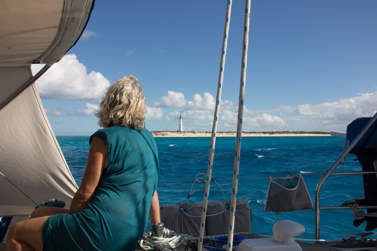
At dawn, we could see the tall white lighthouse on Castle Island although it was still 15 miles away. There’s an anchorage on the south side of Castle Island, which looked like it might be interesting, but when we approached it, we had 2 metre waves and the anchorage looked to be littered with coral heads – we couldn’t see any nice sandy area, so we ran away.
This started a series of failed anchorages. We looked at the west side of Castle Island, but the wind was howling from the north-east making the anchorage look unpleasant. Our next attempt was a few miles north at Datum Bay, which is on South-west Point, but again there didn’t appear to be any sandy area and there was a fair bit of swell coming from the north. To make matters worse, a series of squalls were passing over us, darkening the skies and making it difficult to judge the seabed.
We continued along the coast and anchored at 22°10.91N 074°17.12W in 6 metres depth. The anchor dug in well, but there was a surprising amount of swell coming from the north and after ten minutes, I decided that the boat was rolling too much. Wearily, we pulled up the anchor and headed north, dropping our anchor in a very promising spot at 22°12.52N 074°17.07W in 4 metres depth, just south of Salina Point. It looked perfect – white sand with the occasional bommie, but we couldn’t get the anchor to hold.
I thought that the sand might be better holding in slightly deeper water, so we moved out and dropped in 6.5 metres, but again the anchor dragged. I donned my snorkelling gear and found that the sea bed was beautiful white sand, but only 1” deep over solid rock. The anchor just couldn’t dig in despite me diving down and trying to jam it in.
I had a swim around and thought that the sand might be deeper a little way out to sea, so I had Glenys reverse the boat, slowly dragging the anchor until it finally found a spot to dig in. She slowly increased the revs on the engine and, by the time she got to 1700 rpm, the anchor was completely buried under the surface of the sand. We ended up at 22°12.45N 074°17.11W in 8 metres of water – it’ll do…

It’s a pleasant anchorage, with good protection from the easterly winds and the northerly swell. We’re about 300 metres from the shore, but we’re happy enough. We even have our own coral garden just behind the boat. Later in the afternoon, I went for a snorkel on the coral heads which were very pretty albeit a little deep at 10 metres.
9 February 2019 Acklins to Crooked Island, Bahamas
There’s some strong 20-25 knot east winds forecast for tomorrow and the next day, so we decided to head north to Crooked Island, where hopefully we’ll have good protection.
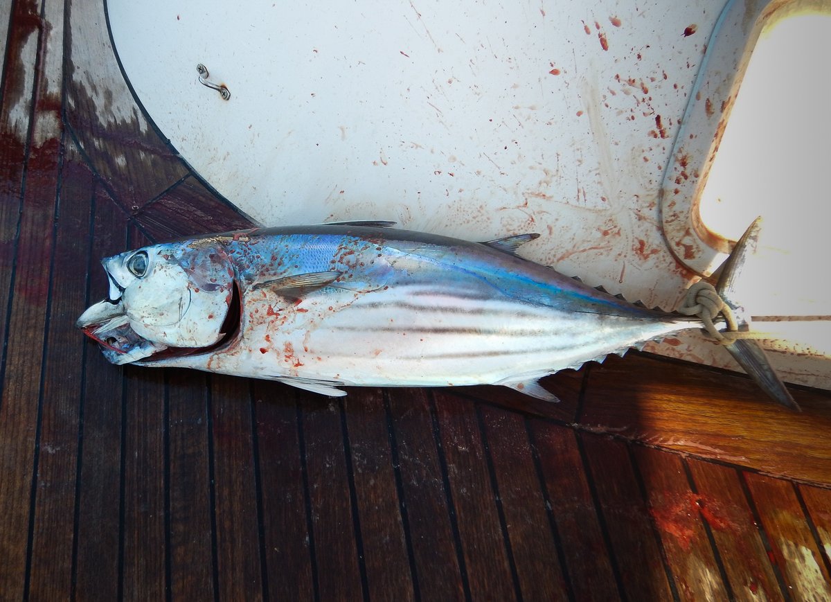
We had 15 knots of wind from ENE, so with our course of 345°, we were very hard on the wind. Despite that we had a very nice sail, mostly due to the relatively small waves in the lee of the islands. There's hardly any Sargassum Weed in the lee of the islands, so I was able to fish most of the way and caught a nice Tuna.
We made very good time and at about 14:00, we anchored to the south of Pitts Town Point at 22°49.15N 074°20.77W in 5 metres on a large patch of beautiful, white sand. When the sun shines, the colour of the water is stunning. There’s a little bit of surge coming around the reef to the north of us, but we should be very well protected from the strong east winds.
10 February 2019 Landrail Point, Crooked Island, Bahamas
It was a horrible day with 25 knots winds and squalls passing through bringing heavy rain, but at least the anchorage is great – we lurked on board all day.
11 February 2019 Pitts Town Point, Crooked Island, Bahamas
The unpleasant weather continued in the morning with strong winds coming from the south east making the anchorage a little more bouncy. I caught up on some administration and signed the broker agreement to sell Alba. Reality hit me when I clicked the button to send the email off to the broker – we’re actually going to sell our home.
The anchor chain has been slipping in the windlass for the past few months, so I dug out a spare gypsy from my spares locker. It’s been used before, but it’s in better condition than the one on the windlass. It was a quick job and fingers crossed, the chain won’t slip anymore.
In the afternoon, in a lull in the squalls, we decided to go over to the lighthouse, which is about 1½ miles away. Unfortunately, the waves were big and confused as we passed by Pitts Town Point – a combination of swell from the north and wind waves from the south east. The waves were 3 foot high and very steep – too much for our little dinghy, so we beat a hasty retreat and went to look for somewhere more protected to snorkel.
The guide book says that there are some under-cut caves and good snorkelling south of Landrail point, but there was too much surge close to the small cliffs, so we went a bit further off shore to a random reef. It was in terrible condition – most of the coral was dead and covered in green algae, so it has little chance of recovering. I believe that these sorts of dead reefs are caused by the local fishermen using bleach to force lobster out of their holes. I don’t think that they do this anymore, but the legacy of human greed will persist for decades.
It really threw it down in the evening. It looks like there’s a front coming down the day after tomorrow, so we’re going to head to Clarence town tomorrow to get some 360 degree protection.
12 February 2019 Pitts Town Point to Clarence Town, Bahamas
At 07:00, there was no wind in the anchorage, but I was expecting 15 knot ESE winds and big waves from the last few days of high winds. So, before we left the anchorage, I rigged up the spinnaker pole to starboard– it’s about five times faster working on a non-moving deck.
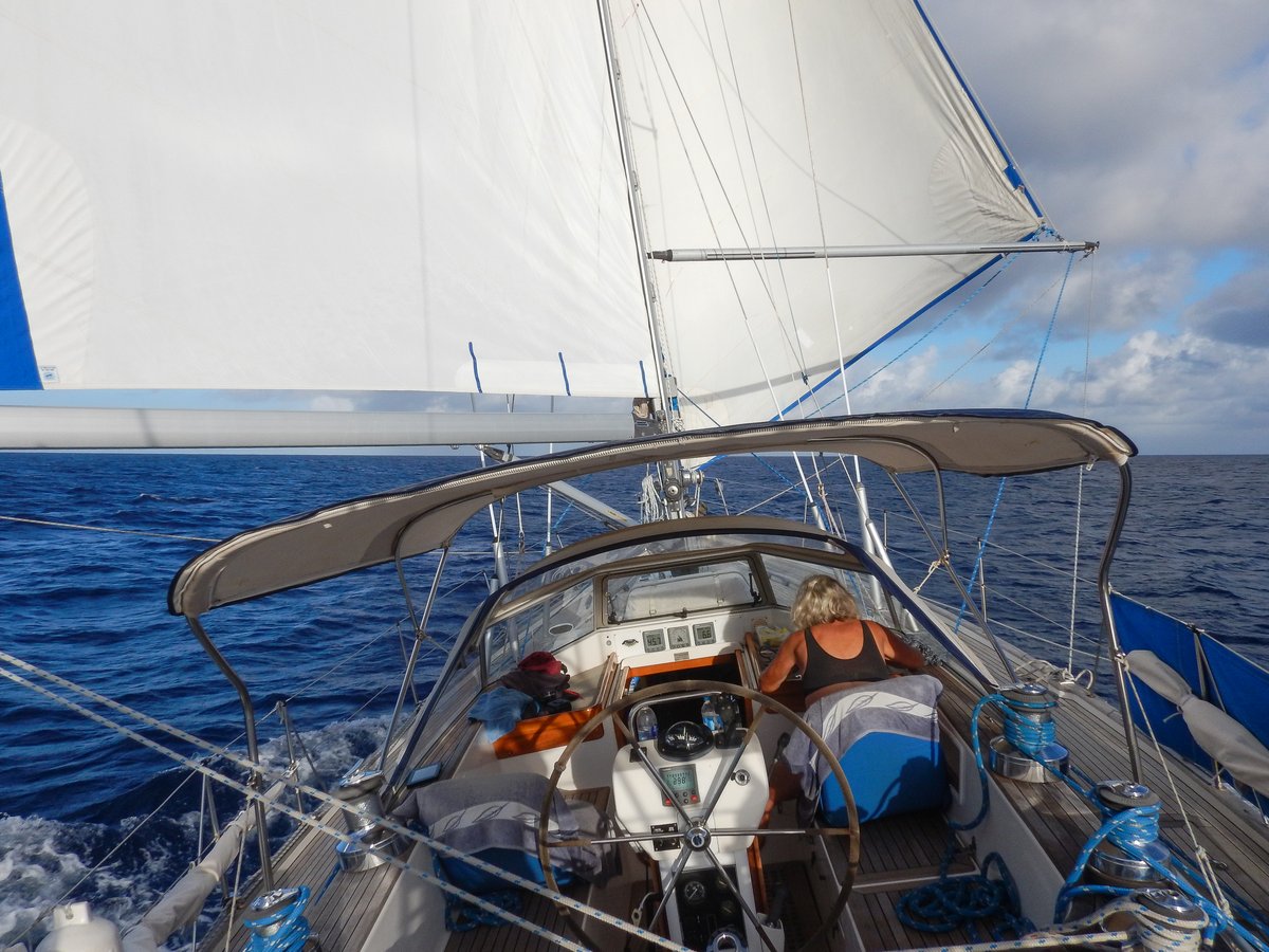
We motored for about 20 minutes, by which time the wind had picked up to 12 knots, so we put the main out to port and pulled the genoa out to starboard. Thirty minutes later, we had 20-25 knot winds with 3 metre seas, so we were cracking along with a reefed main and genoa.
Despite the rolling, it was a very pleasant sail to Clarence Town. To approach to the harbour, we had to go around the north of a headland, passing some scary breaking reefs before we could approach from heading south. We had a look at the anchorage to the south of Strachan Cay, just past Sandy Point, but in the 20-25 knot ESE winds, we would have a lee shore too close behind us.
We came out and anchored to the south west of the island at 23°06.26N 074°57.06W in 4 metres depth on good holding sand and weed. I snorkelled around the boat to check the anchor and there are some patches of rock and rubble around.
It continued to blow a hooley all afternoon, but settled down a little in the evening.
13 February 2019 Clarence Town, Bahamas
The weather forecast shows that a front will sweep its way south today, passing over us tonight. The wind is going to slowly veer from ESE to South to West overnight, presumably with some rain. Fortunately, the wind is only forecast to be 10-15 knots overnight, so it shouldn’t be too bad. The weather for the next three days is very confused with a couple of weak lows and troughs hanging around, which will give us winds from the North-west through to South at 5-15 knots - it looks like we’re trapped here for a few days.
With the wind expected to veer to the south, I had a look at our anchor position and didn’t like the look of a dark patch to the north of us. So, we pulled up our anchor and moved about 50 metres further south-west, away from the shallows. We’re now at 23°06.25N 074°57.11W in 4 metres of water. I snorkelled around the anchor and we’re in a nice flat patch of sand with light weed, so I’m happy here.
In the afternoon, we zipped across to the marina, where we were welcome to tie up to the most western dock. They sell fuel, so I topped up my petrol jerry container. We walked into the small settlement and called in at a small “convenience store”, which had basic items, frozen food and a few fresh onions and potatoes. We bought a few things to last us for two weeks until we get to George Town.
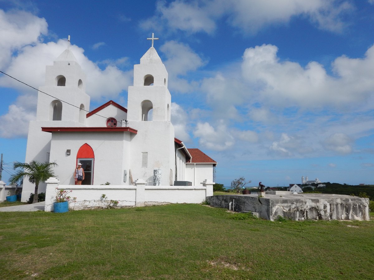
There are two churches in settlement that were built by Jerome Hawes. Originally he was an Anglican Missionary and built St Paul’s church in 1910, He later converted to Catholicism and then built St Peters church around 1939. Both churches were locked up, so we didn’t get a chance to go inside. There wasn’t much else to see, so we wandered back to the boat.
14 February 2019 Clarence Town , Bahamas
At 02:00, a big squall went through giving driving rain and strong winds from the North-west. The bay is exposed to the north-west and 2 foot wind waves soon built up making us pitch badly. It was horrible for about an hour before we fell asleep exhausted.
The weather forecast shows that the front has stalled over us and stretches from Cuba to the north-east. There’s a nasty looking area of squalls possibly with lightning over Cuba and it’s forecast to drift east over the next couple of days. Hopefully the worst of it will track south of us, but we’re bracing ourselves for a lot of rain today and tonight. The winds are forecast to be light and variable until Saturday 17th, but there’s bound to be localised strong winds in the squalls. We’re just going to hunker down here and take what comes for the next 48 hours.
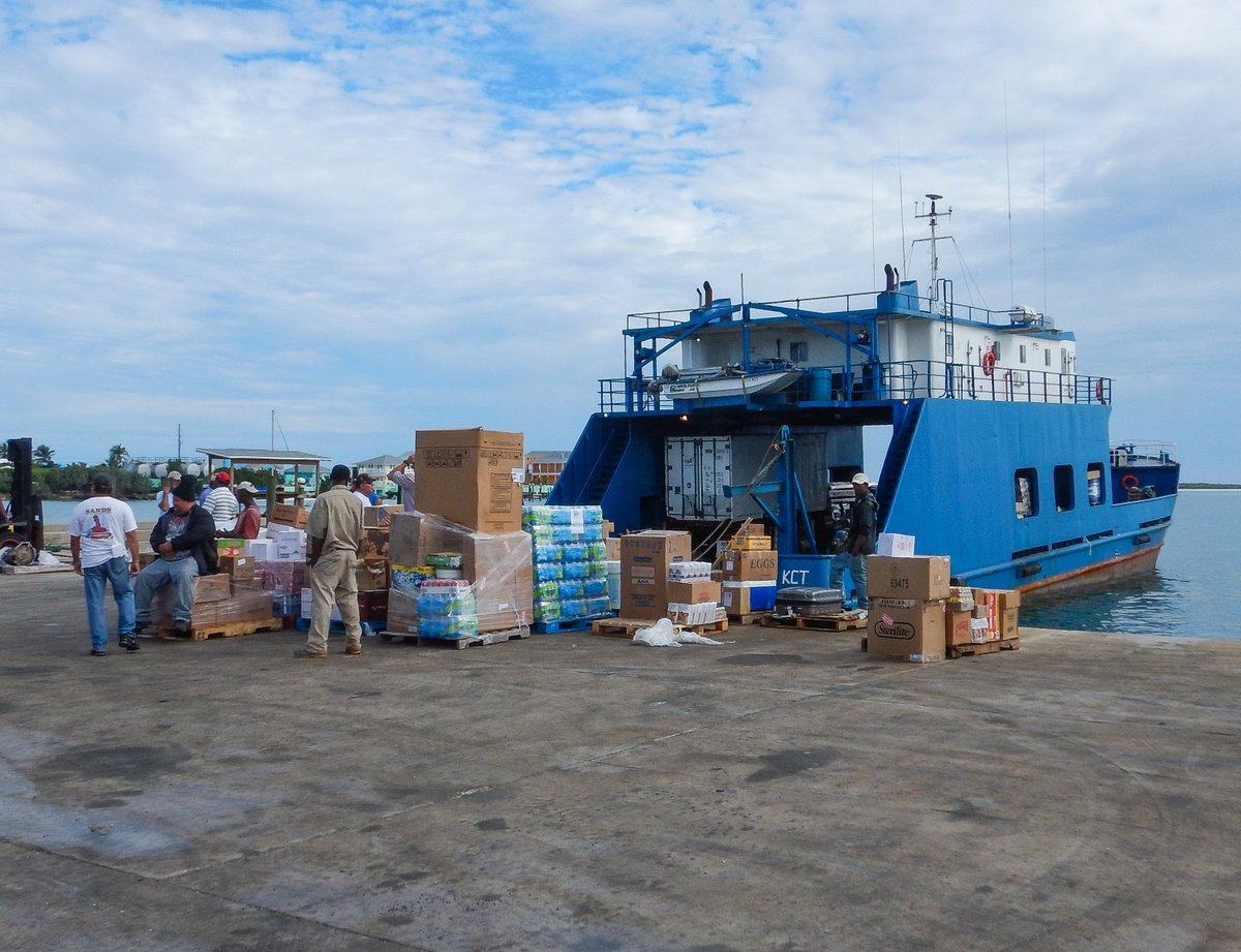
In fact it turned out to be a lovely calm day. We went ashore at 09:00 because the weekly mail boat had arrived. The dock was a frenzy of activity with pallet loads of food and other items dumped on the dock with anxious owners waiting with their pickup trucks.
We were hoping that the island’s farmer’s cooperative would have some vegetables, but they only had a dozen boxes of bananas and a box of Papaya. The farming on Long Island is very low key and I think that most of the vegetables get sold before they get to the Cooperative warehouse. We called in at the convenience store to buy a few more things and retired back to the boat.
Hands-up, it’s my fault. When we tied up our dinghy in the marina, there were a least a dozen large Bull and Lemon sharks circling around the various docks, waiting for a fishing boat to clean their catch. I admit that I did tease Glenys a little bit about not falling in the water while she was struggling to climb up onto the high dock. Of course, when we went back to Alba, she was very nervous about going snorkelling, so we didn’t go – it’s my own damn fault…
We spent the rest of the day doing our own thing. The internet is very fast here, so we mostly indulged ourselves with a lot of web-site surfing. In the evening, we invited Peter and Aideen from “Petima” over for a sunset beer or two.
15 February 2019 Clarence Town , Bahamas
The forecast was for light winds and unsettled weather, so we decided to spend another day lurking about. Again, it turned out to be nice and sunny. Glenys still refused to go snorkelling, but I couldn’t resist the crystal clear water and went by myself. I went to the northwest of our anchorage to the edge of the channel where the seabed drops down to about ten metres.
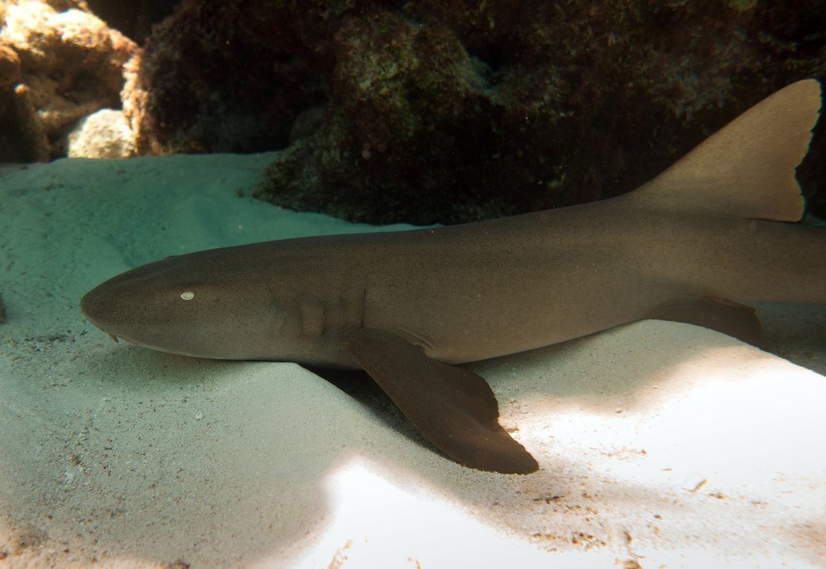
The water was very clear, but the coral is mostly dead covered with a growth of algae and other marine plants. A Great Barracuda joined me within about one minute and followed me around for 20 minutes, no doubt very curious about what I was doing. I didn’t see any sharks apart from one sleeping NurseShark.
We had a quiet afternoon and popped over to “Aideen” for a beer.
16 February 2019 Clarence Town to East Bay, Conception Island
There was no wind today, but we decided to move on to Conception Island. We left at 0700 and motored all day in flat calm conditions. Half way, I hooked two Dorado at once. I tried to gaff the first one, but only succeeded in knocking it off the hook because my gaff is too blunt. I then tried to lift the other one just using the line, be it pulled away. I was really angry with myself, muttering and moaning as I filed a sharp point on my gaff.
We arrive at Conception at about 15:00 with a slight breeze from the west. The wind is forecast to veer to the east tomorrow, so we decided to go into East Bay for the night and move to West Bay when the wind switches. We anchored at 23°50.21N 075°05.62W in 5 metres over good holding sand.
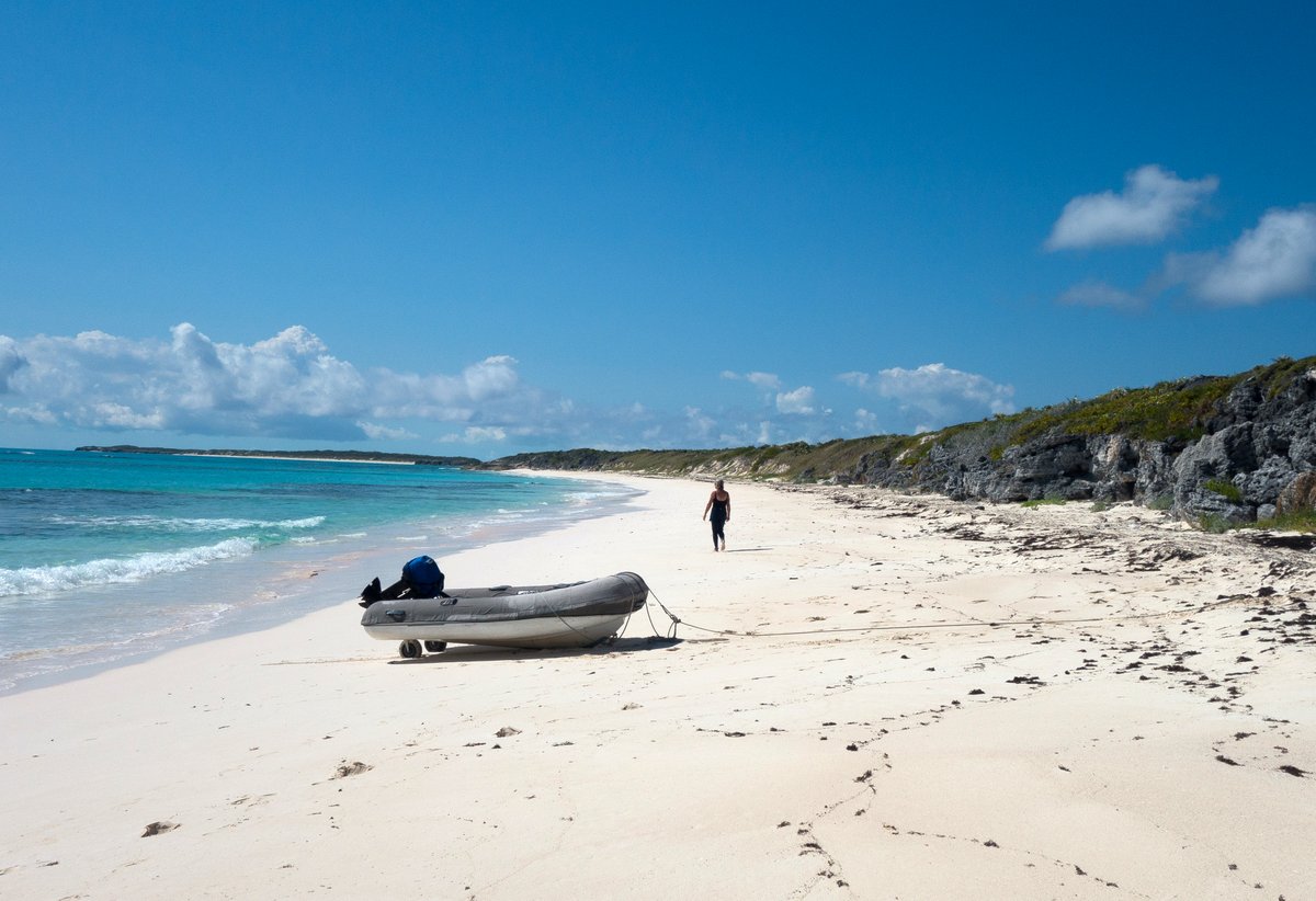
There were three other boats in the anchorage, which is very pretty with stunningly blue water and a white sand beach. A small island called Booby Cay is to the north-east of us, but the prevailing swell coming in from that direction is still hooking around the headland and making us roll a bit.
17 February 2019 East Bay to West Bay, Conception Island
It wasn’t too bad a night with the rolling manageable. Midmorning, we went snorkelling. We tried on a reef inside the anchorage which was better than Clarence Town, but still lots of dead coral and not many fish. After 15 minutes, we headed east and look at a reef further out, but it was the same story, so we gave up.
We went for a stroll on the beach, which has lovely white sand with just a tint of pink when it’s wet. There’s a huge lagoon in the middle of the island, which we could see after clambering up a small 5 metre rocky cliff.
By noon, the wind had just started to come from the east, so we headed south-west out of the 2 mile long bay and headed towards West Bay. The sea bed drops off dramatically from 10 metres to over 50 metres, so there’s an impressive and dramatic change of water colour from light green blue to dark blue.
As we were motoring along the south-west coast, we came across half a dozen dive moorings. There was a sailing yacht already on one mooring, so we picked up another one that looked very strong. We backed up on the mooring to test it and decided that we’d do a scuba dive after lunch. I topped up the dive tanks and we hit the water at about 13:30.
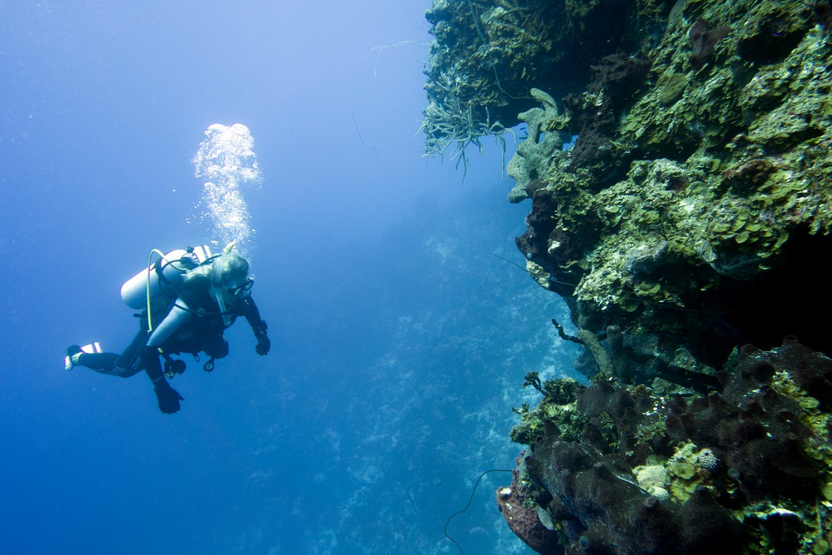
The mooring line descended down to the top of the reef at 18 metres depth. There’s a slope of stunningly white sand coming down to the reef and then the reef drops off dramatically down to 50 or more metres. There was very little current, so we headed south-east, descending down to about 23 metres and swimming along the wall.
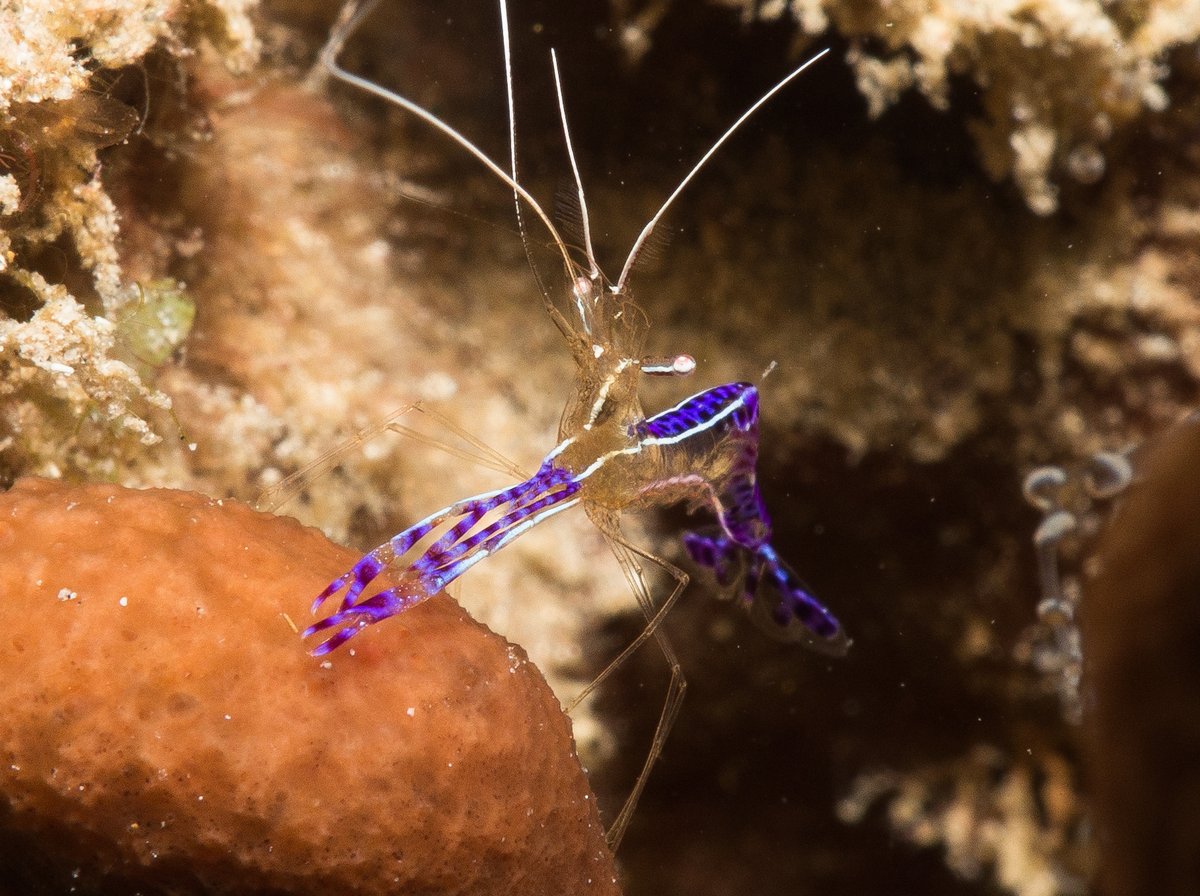
At half tanks, we turned around and swam back along the top of the reef. It was a nice dive with some dramatic scenery, some large grouper, but the colours seemed very muted and there wasn’t much for me to photograph – apart from a few Pederson Cleaner Shrimp. It’s supposed to be one of the best dive sites in the Bahamas – perhaps my expectations are too high.
After tiding up four dive gear, we motored the two miles around to West Bay, where there were 18 other boats anchored – quite a crowd for the Bahamas. We dropped our anchor at 23°50.81N 075°07.36W in 6 metres depth on white sand. The water is so clear that, after we’ve backed the anchor in, we’re motoring forwards and can see how well it’s dug in. A couple of Nurse Sharks came to welcome us and swam around the boat for a few minutes.
We had a peaceful evening with no surge for a change, although as usual, we had a few mosquitos as the sun went down. The Bahamian mosquitos seem to come out at sunset for an hour and then go away. I’ve picked up a couple of bites every evening for the past few weeks – I should have learned to spray up by now.
18 February 2019 West Bay, Conception Island
The east wind has finally arrived and it was a beautiful day. The anchorage started to empty as people took advantage of the wind, so we were down to nine boats by mid-morning. Glenys did some washing and as she was hanging it out some Dolphins called by and swam around us for a couple of minutes. It looked like two mothers and youngsters.
Later in the morning we went snorkelling just to the north of the bay, past some little rock islands. The water clarity was super, but the coral was mostly dead. It’s such a crying shame – there were acres of coral formations, which have obviously been growing for centuries, but they’re all dead and covered with algae and marine plants, just like in the Maldives.
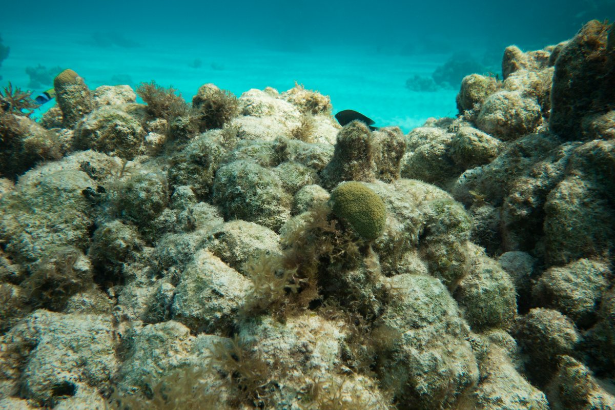
As I’ve said before, the algae prevents the coral polyps from reattaching to the old coral structures, so there’s little hope of the coral recovering soon. People say that the coral was pristine around here ten years ago and many blame the local practice of using bleach to catch lobster. However, the problem is so widespread that I can’t believe that this is the cause here. We’re in the middle of nowhere with no settlements nearby, so is it global warming? – have we seen the last of coral gardens?
There’s a huge lagoon in the middle of Conception Island, so we took the dinghy a mile back along the west coast of the island to where it opens out to the sea. It was supposed to be high tide at 18:00, but there was very little water over the sand bar when we arrived at 15:30. We made our way into the lagoon and tentatively motored around various sand bars, travelling ½ mile up the main channel.
The area is mostly white muddy sand with red mangrove trees growing along the edge of the waterways. We were surprised by the lack of birdlife and the mangroves were very small - maybe 2 metres in height at the most. It’s a pretty enough area but I wouldn’t waste the petrol to go again.
19 February 2019 West Bay, Conception Island
We were planning to go scuba diving this morning, but it was very windy with 90% cloud cover, so we prevaricated over breakfast. When it started to drizzle, we abandoned the idea – it would be dark and dismal at 25 metres. It didn’t clear up all day, so we lurked around on-board.
20 February 2019 West Bay, Conception Island
After breakfast, we took Alba a mile around the corner to see if we could manage to do a dive today. Unfortunately, it was blowing a hooley with 2-3 foot waves, so having looked at the mooring crashing about, we abandoned the idea. I’m really glad we did a dive a few days ago while it was calm winds.
We’ve not seen any beer on sale since we left Puerto Rico three weeks ago, so we’re now down to one lonely can. It’s time to move on and we’re hoping that we can get some beer in Cat Island.
21 February 2019 West Bay to Old Bight, Cat Island
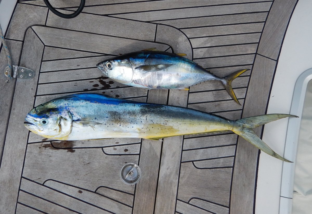
We set off towards Cat Island at 07:00. It was a pleasant sail with 15-20 knots of wind behind us, but it was a bit rolly with 3 metres waves. We hooked two fish and I was extremely careful to make sure that I landed them. We ended up with a nice Dorado and a small Yellow-fin Tuna.
It was a long way from the south-west corner of Cat Island to the anchorage off the Old Bight settlement. There are about a dozen boats here sheltering from the strong winds.
Alan and Claire from “Moonstone” invited us over for a beer (after I’d told them our sad story about having run out…)
22 February 2019 Old Bight, Cat Island
We were planning to go down to New Bight which is about 4 miles along the coast, but the weather was a bit unsettled and we had some torrential showers. Instead we had a day pottering about on-board. The broker in the USA has sent us the sales literature for Alba, so we sent a few emails back and forth with amendments.
23 February 2019 Old Bight, Cat Island
It was a much nicer day today, so we upped anchor and had a lovely sail down to New Bight. The water is very shallow a long way out, so we dropped anchor about 600 metres off shore at 24°17.15N 075°25.26W in 3.4 metres depth. There’s quite a fetch and the 15-20 knot winds were raising 2 foot wind waves, but the holding was great in white sand.
We went ashore and landed our dinghy on a small beach next to the old concrete dock near the Batelco antenna. The Police Station was across the road, so we popped in to ask for directions to the grocery store and the liquor store. The police woman was very friendly and she pointed out the road to the Hermitage, which is about 25 metres to the south of the police station.
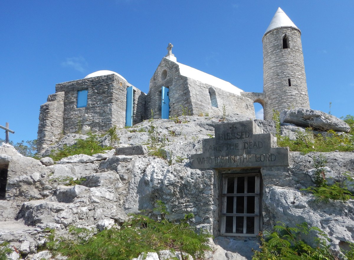
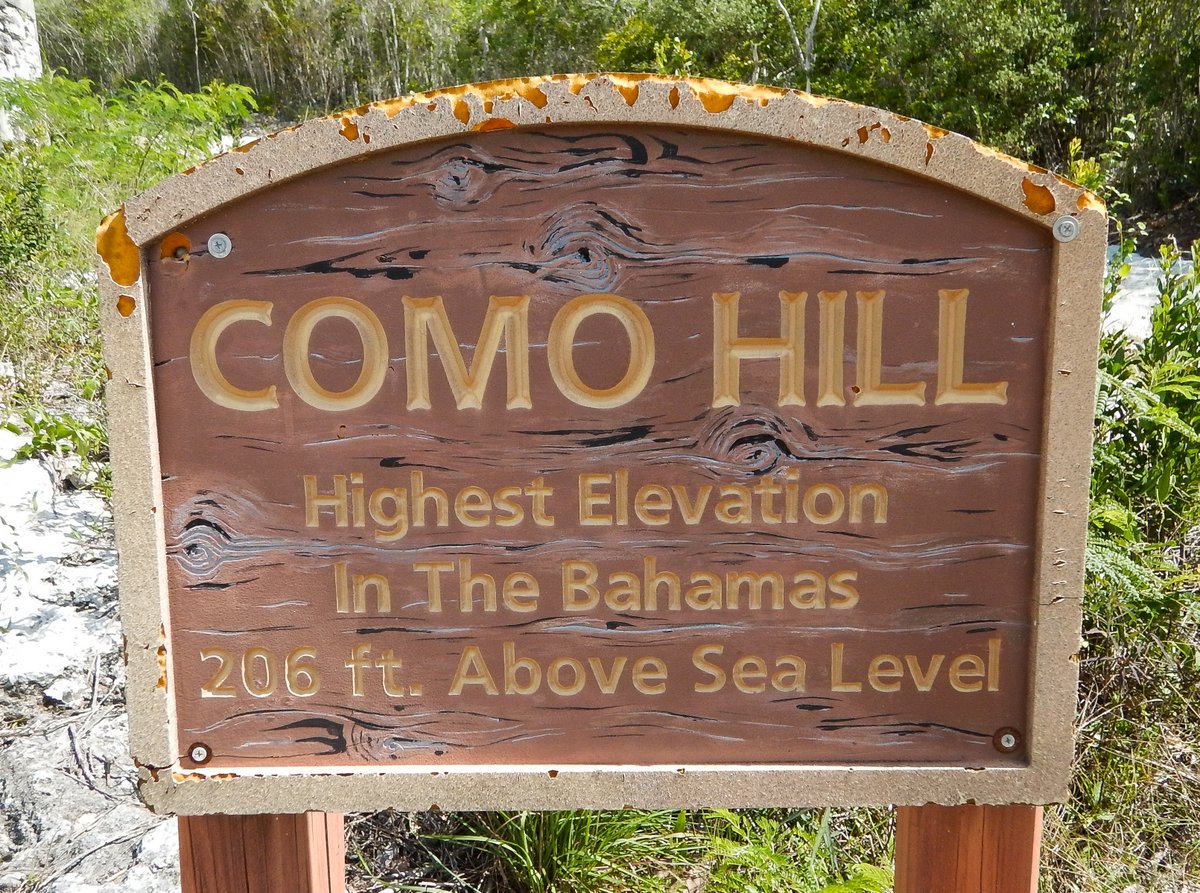
Before going shopping, we walked the ½ mile to the Hermitage, which was built by Father Jerome, who built the two churches in Clarence Town. For many years, he lived as a hermit on this hill, which at 220 feet high, is the highest point in the Bahamas. It’s an interesting little place. Father Jerome had a tiny bedroom, a kitchen a living area and a chapel. The place even has a little bell tower complete with a working bell. It also has a fabulous view of the turquoise sea. Father Jerome was buried at the Hermitage.
We strolled back down to the main road and headed south for ½ mile to the liquor store, which is very modern, air-conditioned and very well stocked. As expected, it wasn’t cheap with a case of the local Kalik beer costing $42. However, they had reasonably priced ginger beer and a local Bahamian rum only cost $12 for a litre. We splashed out on one case of beer and a bottle of rum.
The liquor store had a pickup truck parked outside and I was hoping that they would drop us and our purchases off at the dinghy, but this seemed to be a big problem for them. I think that it was something to do with both of the guys had to be in the shop at the same time. Instead, there was another guy hanging about, so it was arranged that he would drop us off for a small tip.
I said that I thought $2US was fair and it appeared to be agreed that this was okay for the ½ mile drive. Our new friend (who looked to have consumed a few fifths of rum) took us to his very dilapidated car and dropped us off at the beach. I thanked him and handed over a couple dollars, which he refused to take, saying that he wanted more.
We then had a stalemate, I refused to give him anymore because that was what we’d agreed and he said that it was an insult and I was taking advantage of a black guy. I tried to be reasonable and pleasant about it, but he eventually drove off in a huff. That’ll teach me for dealing with drunks.
Glenys nipped across the road and bought some bread at the small bakery – they also had some tomatoes, so Glenys bagged the lot. We took our booty back to the boat and then beached the dinghy ½ mile further north next to a load of colourful beach bars.
It was then a long walk of at least a mile to the grocery store. The grocery store was good and Glenys has stocked up on enough vegetables to last us a week until we get to Georgetown. I managed to thumb a lift in the back of a pickup truck, which was a great relief.
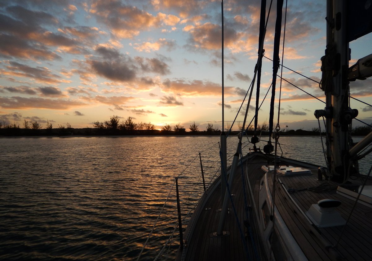
By the time that we’d loaded our things on board Alba it was 13:20, so we upped anchor and Glenys made lunch, while we were motoring back to Old Bight. It’s a much better anchorage here. Now that we had some alcohol, we invited “Moonstone” over for a few beers. It’s nice to meet some Brits who are on the same wavelength as us, but unfortunately, they’re going in a different direction.
24 February 2019 Old Bight to Rat Cay, Exumas
The weather forecast shows light winds tomorrow, so we left early to sail 45 miles south-west to the Exumas. We had a cracking beam reach all the way there, with 1-2 metre seas and blue skies, so we arrived at the cut to the south of Rat Cay at 14:00.
The entrance is a little narrow, but is well protected from the prevailing south east swell, so we entered without any problems. We followed the suggested route on the chart and motored around the island trying to stay in deep water (i.e. more than 3 metres). I was suckered into a dead end tongue, but managed to find a 3 metre spot over a sand bar – I should have hugged the island shore all the way.
I find it very stressful navigating in these shallow waters amongst sand bars, but I suppose that I’ll get used to it. We safely made it to the anchorage at the north-west side of Rat Cay and anchored at 23°43.89N 076°02.94W in 3.5 metres of water on good holding sand and light grass. It’s a nice anchorage, protected from SSW to East to North. We had a quiet night and evening, recovering from our early start.
25 February 2019 Rat Cay to Leaf Cay, Exumas
Our mission is to explore some anchorages where we can take our son, Craig when he arrives in two weeks’ time, so we headed a bit further north to Lee Stocking Island. There are recommended routes on leeward side of the Exumas, but most have sections that are too shallow for my nerves. We retraced our route out to the seaward side of Rat Cay and motored along the islands with very little wind.
It looks like the morning is the time when everyone moves because our AIS showed dozens of American and Canadian cruisers sailing along the island chain – Exuma Rush Hour. It only took us an hour to get to Adderley Cay, where we negotiated the pass and weaved our way through sand bars to Leaf Cay.
The anchorage is shallow at 2.5 – 4 metres and the sea bed is sand and grass, so it was difficult to see the shallows, so I motored around a bit to check out and area greater than 3.5 metres (kind of like a cat circles before it lies down). I ended up with a circular track on our chart platter, showing me an area that was deep enough for us and dropped my anchor in the middle. We ended up at 23°47.06N 076°07.75W in 3.5 metres, good holding.
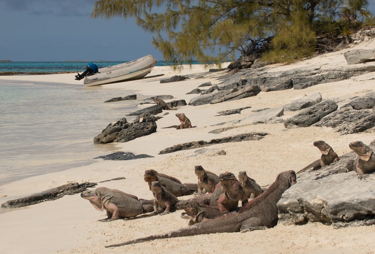
After lunch, we went to the beach on the west side of Leaf Cay, which is a popular tourist attraction. There’s a constant stream of powerboats taking tourists up and down the islands, mostly heading for Big Major Cay, where the famous Swimming Pigs live. Leaf Cay is a stop for them because there are large “pink” Iguanas who live on the island. The hordes of tourists bring little snacks for the iguanas, so there are dozens of them sunning on the hot sand and rocks.
Glenys had brought some pieces of pear, so she fed them while I took some pictures. As with all beaches in the Bahamas, the sand is beautifully white and the water colours are stunning. After 15 minutes, I’d reached my threshold of Iguana-staring, so we returned to Alba and picked up our snorkelling gear.
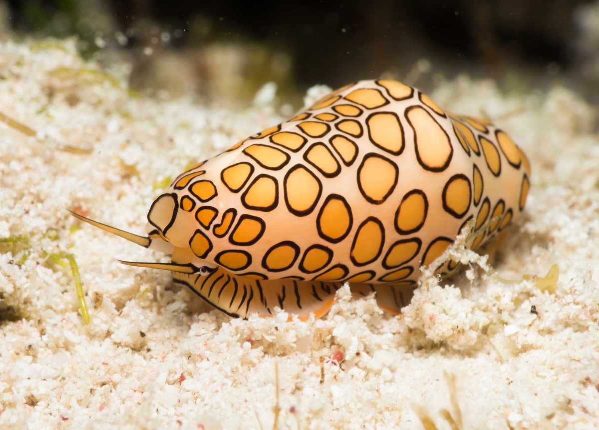
We first went to shallow bay on the north-east of Norman’s Pond Cay (about 23°47.18N 076 08.10W). It was only a couple of metres deep, but there were some pretty coral heads and I found a very photogenic Flamingo Tongue crawling across a rock. They’re normally found on sea fans, which are constantly swirling around, so it’s hard to photograph them. This one was slowly inching its way along the rock, so I spent a happy 10 minutes taking macro pictures.
We then went to a reef just south of a yellow navigation marker at about 23°47.38N 076°08.33W. It was a nice bit of reef with hard and soft corals and plenty of fish. The water was crystal clear, but there was a fairly strong current. I’m pleasantly surprised about how good the snorkelling is in this area.
A strong current runs through the anchorage and later in the evening, the wind picked up to 15 knots from the south-east. By ten o’clock, the tide was ebbing and flowing out towards the south-east creating a bit of a chop. Alba was pointing into the current, so we had wind-waves slapping underneath our sugar scoop stern. It was noisy in the back cabin with an unsettling, jerky motion – were we dragging? It was hard to fall asleep.
26 February 2019 Leaf Cay to Rat Cay, Exumas
The tide turned at 01:30 and the change in the motion woke me up. I wearily climbed out of bed and found that we were pointing into the 15 knot wind and the waves, which was much more pleasant. It was a pitch black night with no reference lights on shore, so I had a quick look at our tablet to confirm that we were still anchored in the same place. I slept soundly for the rest of the night - I wouldn’t like to be here in very strong winds.
We waited for the sun to get higher in the sky and then motored east towards Lee Stocking Island. It looks to be a great anchorage, but it’s too shallow for our 2 metre draft. There’s supposed to be an anchorage “behind a shallow sandbar” (at 23°46.11N 076°06.96W), but there were 2 foot wind waves even in the 15-20 knot wind.
The water gradually shallows on the sand bar, so we dropped the anchor in 4 metres depth to give us time to decide what to do next. This was a mistake, because there was a very strong current which pushed our chain against the hull making a horrible grinding noise, so we only stayed 5 minutes.
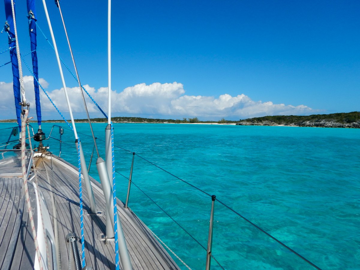
Looking at the charts, we couldn’t see anywhere nearby where we could comfortably anchor. There’s one anchorage about 10 miles north, but it looks open to the south-east and is probably affected by string currents. We decided to head back to Rat Cay, which had been lovely the previous day.
It was a hard bash, motoring almost directly into the 2 metre waves and 15-20 knot wind, but 90 minutes later, we were in the relatively calm waters behind the islands. We anchored in approximately the same place as before and the wind was coming directly from the shore, so it should have been a good anchorage. Unfortunately, there was an irritating surge caused by the waves hooking around the corner. This made us rock and roll a little, which was disappointing. I’m rapidly coming to the conclusion that the Exumas aren’t a great place to be in strong winds…
We had quiet afternoon and evening.
27 February 2019 Rat Cay, Exumas
The surge gradually became worse during the morning and by mid-day, we had a two foot swell hooking into the anchorage. The wind had veered to southeast and was blowing 20 knots making the anchorage into a cauldron. It was a horrible afternoon rolling around. We know that the wind will drop tomorrow, but we had to endure today.
We just pottered about, not able to concentrate on anything much. However, it’s a pretty place and there’s good internet access via the Batelco tower a few miles away.
28 February 2019 Rat Cay, Exumas
We had a relatively peaceful night, with a few bouts of jigging about as the tide changed. Daylight brought us lighter winds and the surge was much better. Our plan is to bring Craig and Kristen here next week provided that we have some light winds.
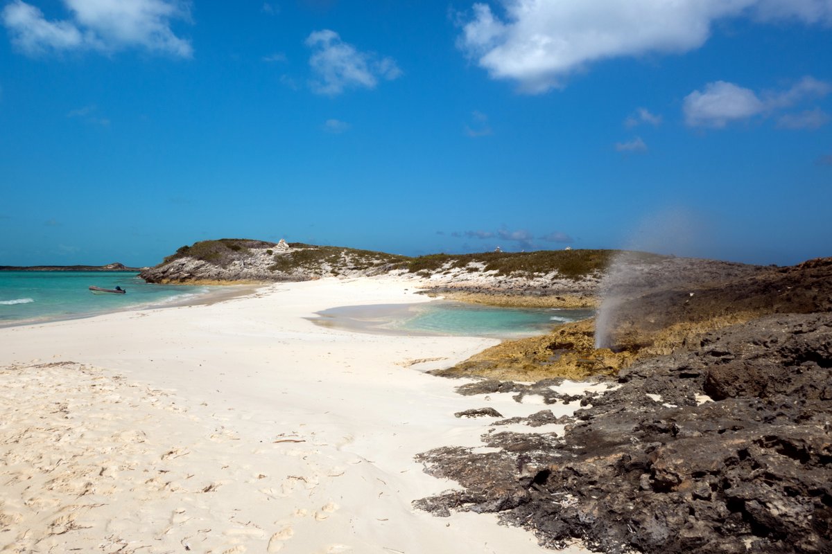
Mid-morning, we went to look at possible snorkelling spots in the area. However, the strong winds have churned up the water and the visibility wasn’t good. We had a look at the rocks to the north of the anchorage, but there was a strong current and the reef didn’t look too appealing. It was the same situation all the way around Pigeon Cay, so we zipped over to Boysie Cay to have a look at the impressive blow hole and then retreated to the boat.
We had a quiet afternoon. I went ashore to see if there were any trails on Rat Island, but the bush is thick. Ross and Phyllis invited us over to “Kohina” for sun-downers and we got on so well that they invited us to stay for dinner to help eat a lobster that Ross had caught on the outside of the channel into Rat Cay.