
1 April 2019 Highbourne Cay to West Palm Beach, Florida (Day 2)
At sunrise, we had fluffy white clouds with blue skies. After 24 hours of solid motoring, we were pleased that the wind picked up to 15 knots from the south allowing us to finally turn the engine off and sail on a beam reach. Later in the morning, we hooked a nice Dorado, which I gaffed and landed ok. It bled profusely, so by the time that I’d subdued it, the aft deck was covered in blood – took me nearly an hour to fillet the fish and clean up the mess. Glenys served Fish Tortillas for lunch, which was lovely.
The Gulf Stream is very strong where it runs up the coast of Florida – we estimated that we’d have an average of 2 knots of current pushing us north. It’s inefficient to steer into a strong current, so I used a bit of old fashioned vector navigation. I worked out that our destination was 60 miles on a course of 305°. At an average boat speed of 6 knots, it would take us 10 hours. The 2 knot current would push us 20 miles north in 10 hours, so we set a course of 285°, aiming for a waypoint that was 20 miles south of West Palm Beach.
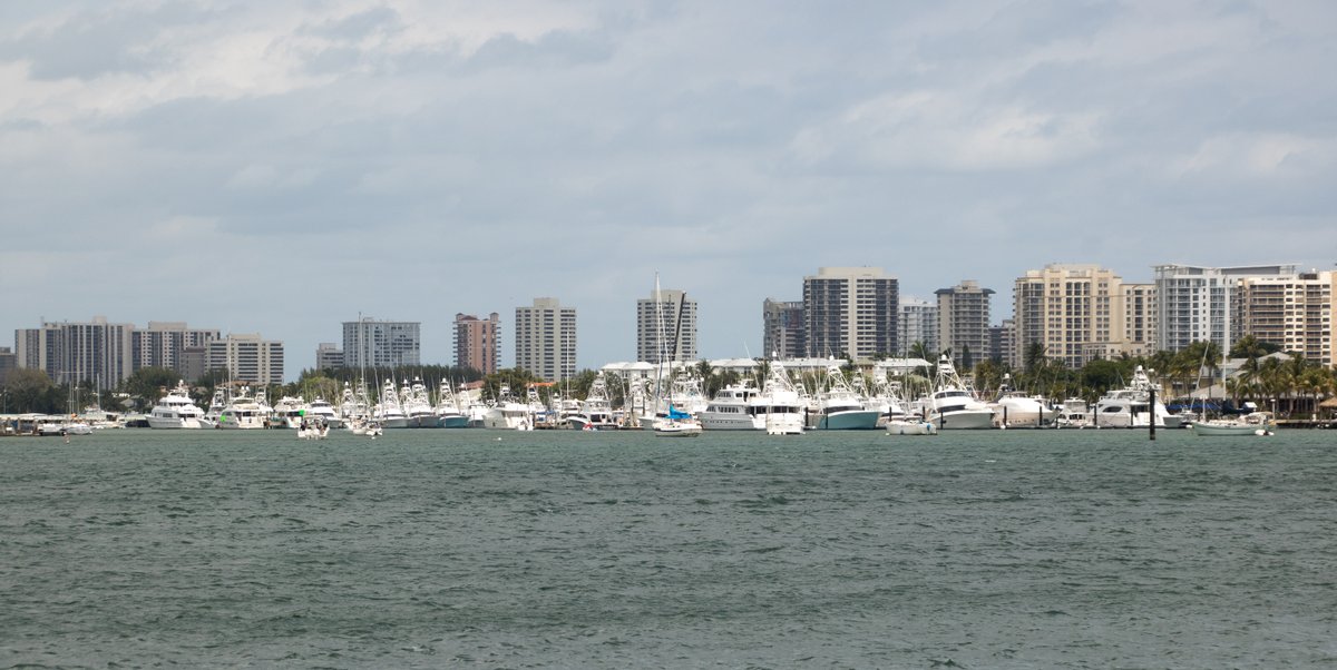
Unfortunately, after only five hours of sailing, at midday, the wind dropped below 10 knots. By this time, we were still 50 miles from West Palm Beach and had only seven hours of daylight left. If we kept our average speed over 7 knots, then we’d have a chance of making landfall before dark, so instead of plodding along at 4 knots, we turned on the engine and went for it.
We maintained our heading of 285°, which worked out well, giving us a curved track over the ground and brought us out close to the inlet at West Palm Beach. As we approached the inlet, there were some nasty looking thunder clouds building to the north of us, but thankfully, they kept their distance.
By 19:00, we were motoring into the West Palm Beach inlet and anchored at 26°46.02N 080°02.61W in 7 metres depth. There are a few boats around us and scores of boats at anchor further south. We’re glad to be here before dark.
2 April 2019 West Palm Beach, Florida
It was a lovely calm night and we woke to a gentle breeze from the west. West Palm Beach is a busy commercial port and there are half a dozen big freighters and one huge cruise liner moored across the harbour from us. The water-front next to our anchorage is lined with expensive looking houses, most of whom have small power boats moored or lifted out of the water.
We dropped the dinghy into the water and zipped across to the Riviera Beach Marina, where we found a dinghy dock. I was expecting to be charged $10US to leave our dinghy there, but no-one seemed to be bothered. The Customs and Border Protection Agency (CBP) is in an impressive, six story building right next to the marina.
The CBP officer told me that before he could process my clearance, I had to either use their “CBP ROAM” mobile app or ring a telephone number to obtain a clearance number. I tried to explain that it was a Catch 22 situation - I didn’t have a SIM card in my phone, so I couldn’t access the internet or ring anyone, but he wouldn’t listen and told me that it was my responsibility to follow the correct procedure – very helpful. I asked him where I could use a phone and he said that I “might” be able to use one in the office on the floor above.

Despondent, we took the elevator up to the third floor, where a very helpful man showed us to a room with a telephone with a sign stating that the phone was for the use of clearing into the country. I rang the relevant telephone number and was put through to a CBP officer, who told me that the other CBP officer should be able to do everything for me and point-blank refused to register our entry over the telephone. I took Officer Caseries’ name and went back down to do battle.
The officer downstairs listened to my plaintive plea and said that he’d be talking to Officer Caseries. I thought I was going to get caught up in office politics, but after a minute he came back and tersely took our passports and cruising permit. He then grumpily started to type our details in to a computer. I sat down and tried to look innocuous. He stretched the process out to 30 minutes, but it didn’t cost us a penny to get six month visas. We thanked Officer Grumpy and beat a hasty retreat.
Our next mission was to get a SIM card for our phone – we’re social outcasts without a phone and internet access. We wandered back to the marina and asked in the office about somewhere to buy a prepaid SIM card. The lady thought that we might get one in Walgreens, which is a drug store. She kindly rang Walgreens, but they didn’t seem to know whether they sold SIM cards. We decided to walk the 10 blocks to have a look.
The wide main road was lined with single-story, flat roofed buildings selling a diverse range of items. We saw couple of seedy looking bars with flashing Budweiser neon signs; a T-shirt shop; a couple of “grill” restaurants advertising “subs” & “50 types of chicken wings”; and a Pawn shop. We even saw a State Trooper driving past on his big Harley Davison - we’re definitely in America.
Walgreen’s had a good range of prepaid SIM cards, so we bought one for AT&T. I installed the SIM card and read the instructions. I then bought a $65 card to top up the phone and buy an unlimited internet package. All seemed to go well until I tried to register the phone and the top up. Nothing seemed to work – the instructions told me to type in an activation code, which didn’t work. The alternatives were: ring 611, which didn’t work; ring an 800 number, which didn’t work; go online to the att.com website, which the phone wouldn’t let me do – Catch 22 again.

I needed an internet connection or a land-line to sort it out. The staff at Walgreen didn’t have a clue, so we wandered off to see if we could find a Wi-Fi signal. We ended up in a Publix supermarket, standing in their entrance foyer connected to their Wi-Fi, using Skype to ring the 800 number. After waiting in a call centre queue for 5 minutes, a very patient lady helped me to set up an account and registered the phone on their network. It was a stressful 20 minutes while Skype faded in & out and the supermarket’s background music made it hard to talk.
In retrospect, it was a good thing that I couldn’t do the registration myself because the expensive $65US/month, unlimited package wouldn’t have allowed us to use the phone as a “hot spot”. This would have been a disaster because we wouldn’t have been able to connect to the internet using my laptop and Glenys’ tablet. The lady told me that the best option was a $50US/mth package that allowed a hotspot – it only gives us 8GB at high speed, but that’s okay.
After becoming part of civilisation again, we wandered around the supermarket, bought a few things and retired back to the boat. I had a quick nap and was still reading in the back cabin, when the boat suddenly & violently heeled over 30 degrees as a huge squall hit us. Glenys had been watching the thunderstorm approach and had just attached the side panels and closed the hatches, when it hit. We had winds of 40-50 knots and horizontal rain for 10 minutes – quite horrific. Visibility went down to 10 metres and all the boats in the anchorage were heeling over at 30 degrees in the gusts. Thankfully, the holding is excellent and no one dragged.
Within 15 minutes, the skies cleared and we were left with lovely blue skies and a 5 knot wind. We invited Elvira and Alfons from “Murada” over for a few beers.
3 April 2019 West Palm Beach, Florida
After breakfast, we had another long debate about the weather and how we’re going to get to Annapolis, which is still 900 miles away. Today’s forecast is for north winds, while tomorrow and Friday will be west to south-west winds. At first glance, it looks to be good to sail overnight (160 miles) up to New Smyrna. However, there’s a huge area of thundery weather building up to the west of Florida tomorrow, which is forecast to hit New Smyrna on Friday afternoon.

After experiencing the gale force winds in the squall yesterday, we’ve decided to avoid all thundery weather so tomorrow, instead of sailing overnight, we’re going to have a long day sail to Vero Beach which is 62 miles away. The forecast for the next week is for continuing unsettled, thundery weather, so we’re going to take it easy and slowly motor up the Inter-Costal Waterway (ICW), taking 10 days to get to Fernandina (about 265 miles away).
From Fernandina, we’ll sail outside along the coast to Beaufort, North Carolina, which is 360 miles. If we get a good push from the Gulf Stream, that passage will take us 2½ days. We’ll then have 5 days of motoring up to Norfolk and then there’s only 120 miles to Annapolis. The Annapolis Boat Show starts on the 26th April and it would be good to get there to promote the sale of Alba, but unless we have perfect weather, I think that we’ll miss it.
After our planning session, we moved our anchor because we were swinging within 2 metres of an unoccupied mooring. I then went up the mast and checked that I could easily remove the VHF antenna. The ICW has many bridges along its length. Some are lifting Bascule bridges that open at certain times, but there are also fixed bridges, which should have a minimum clearance of 65 feet. Our mast is 62.5 feet high including the tricolour light, but our VHF antenna sticks up 4 foot higher, so I’ll have to remove it when we start going up the ICW.
In the afternoon, we walked to the Publix supermarket and bought lots of goodies that we’ve been missing out on. We were very hi-tech and called an Uber to take us back to the marina – it’s nice to be back in civilisation. In anticipation of the release of Season 8 of “Game of Thrones” later this month, we started watching season 1 with the intention of bingeing all seven seasons before we get back to the UK.
4 April 2019 West Palm Beach to Vero Beach, Florida
The alarm went off at 06:30 and we upped anchor just as the sun rose over the horizon. We motored out of the anchorage to find a huge cruise ship approaching the entrance, so we thought it prudent to get out of the narrow shipping channel and circle around for a few minutes.

The tidal current was coming in at 2 knots and, despite there being no wind against tide effect, the sea was very lumpy as we motored away from the land. We continued motoring at 45° to the shore to get out of a ½ knot counter current that was running along the coast.
We made the mistake of listening to the local coast guard weather forecast, which errs on the side of mega-safety – “Small craft advisory … 6-8 foot seas … high chance of thunderstorms coming from the Atlantic … possibility of waterspout formation in local waters … Yikes! We spent the whole trip warily watching every cloud approaching from the east.
In fact, it turned out to be a lovely day-sail with a 15 knot east wind putting us on a beam reach. We passed underneath a ½ mile wide cloud lane, which gave us 20 knots of wind, but despite slowly following us north, it didn’t develop into thunderstorms.
We arrived at the Fort Pierce Inlet at the wrong state of tide and had to endure a 3 knot tidal current against us. The 15 knot east wind and 4-6 foot swell were directly against the current, so the entrance was a boiling cauldron with 6 foot, very steep, breaking waves. Our speed over the ground was reduced to 3 knots and the waves veered us around, heeling us over 40 degrees at times. It was an unpleasant 10 minutes, but very entertaining for the tourists watching from the breakwater.
After we’d clawed our way to the ICW, we anchored in a very tight anchorage and I scooted up the mast, removed the VHF antenna and we were back underway within ten minutes. We had two remorseless hours of motoring along the narrow ICW channel, following the marker posts. After passing under two 65 metre high bridges (thankfully without hitting them), we arrived at Vero Beach Marina .
Also known as “Velcro” Beach, this is a popular cruiser destination where it’s easy to stay for a few weeks. The municipal marina is in a channel just off the ICW and they’ve installed lots of very strong moorings. The place is so popular that it’s normal for boats to raft with two or even three boats to a mooring.

We were assigned to moor with a classic-looking, 50 year old, 36 foot yacht called “White Seal”. There was nobody on-board, but we managed to dock without causing any damage. Charlie & his daughter, Mary appeared 30 minutes later, so we invited them over for a beer.
5 April 2019 Vero Beach, Florida
Vero Beach is very cruiser friendly and even lays on a free bus to take cruisers into town. We caught the 0945 bus, which took us along the beach front road and then across the ICW into town, dropping us off at the Publix supermarket mall. We didn’t need anything in particular, so we just wandered around for an hour, bought a baguette and caught the bus back to the boat.
After lunch, Glenys took a big bag of laundry ashore to use the marina’s washing machines. At the same time, she had her hair cut by a fellow cruiser, who is a retired hairdresser. It’s the first haircut that she has had since we left the UK in October and it was a good one.
A huge thunderstorm came over the area and stayed until well after dark, so we abandoned our plan of going out for a meal and lurked down below, watching Game of Thrones.
6 April 2019 Vero Beach to Cocoa, Florida
We dropped the mooring at 07:00 and motored out into the ICW. It was beautiful and calm for the first hour and very pleasant motoring along especially because the first part was fairly narrow with the shore close to us. There are lots of Ospreys nesting on the marker posts, so I entertained myself taking photographs.
Later on, the waterway gradually became wider and more boring with nothing to see apart from a line of marker posts and lots of water. We soon started a one-hour watch system with one of us on duty for an hour while the person could relax. As the day wore on the ICW became busy with loads of small power boats buzzing around enjoying the sunny weekend.

There were no lifting bridges on the 45 mile route, so we made good time arriving in the anchorage at Cocoa at 14:30. We dropped the anchor at 28°21.11N 080°43.12W in 3 metres depth. The anchorage is about ¼ mile from one shore and ¾ mile from the other shore, so there’s not much protection, but the weather forecast is for fairly light winds.
At 17:00, we braved the 2 foot wind waves and went ashore for dinner. The only place to leave the dinghy is by a boat ramp, tying alongside a concrete wall, which was taking the full brunt of the wind waves, so we were a bit reluctant to leave the dinghy there and sure enough when we arrived back, the abrasive wall had worn through two thickness of our dinghy cover.
We went for a stroll around the cute “old” town of Cocoa, which has lots of bars and restaurants. After a beer in an “American” bar, we walked to a Mexican Restaurant. I’ve been looking forward to having an “American” Mexican meal, so I ordered a deluxe combo plate – Taco, Chilli Rellano, Tamale, Enchilada, Refried Beans and Mexican rice all smothered with melted cheese. It was a huge meal, but I managed to stuff it down – Glenys had a Taco Salad that was equally huge.
We waddled back to the boat and watched a couple of episodes of Game of Thrones.
7 April 2019 Cocoa to Titusville, Florida
After a leisurely breakfast, we decided that there was no point in staying at Cocoa, so we upped anchor and motored 15 miles past the Cape Canaveral Space Centre to Titusville . We anchored to the north of the mooring field at 28°37.77N 080°48.38W in 2.8 metres depth – we’re getting very blasé about shallow water.

We spent most of the day doing research about the ICW north of here. We still plan to continue up the waterway to Fernandino Beach, but there are some sections that are shoaling due to sand and mud movements near some of the inlets and we’re going to have to be careful. The weather is so unsettled at the moment that there are only very small weather windows, so we’re thinking that we might also need to use the ICW between Fernandino Beach and Beaufort in North Carolina.
Unfortunately the section from Fernandino Beach to Cape Fear has some very shallow sections with depths less than 4 feet in places. This will make it a challenge for our 6’8” draft. Even if we use the tides, we’ll probably be restricted to about 4 hours travel each day. That’s only 20-25 miles per day and with 500 miles to go to Beaufort, it would take 20 days – if we can sail outside then it would only take 4 days.
After much research, it appears that we might be able to make it through the section from Cape Fear to Beaufort, which is about 100 miles, but that looks very fraught in many places, so we’re hoping that we’ll have the weather to sail that section outside as well.
In the evening, I was getting annoyed by a kind of high frequency rattling. I checked all the halyards and the bimini side panels, but couldn’t pin down where the noise was coming from. Glenys noticed that the noise seemed to be coming from below rather on deck, so I opened one of the bilge hatches to have a listen. Sure enough the noise was very loud beneath the floorboards and we eventually decided that it was Barnacles or Shrimp on the hull making the noise – thankfully they went quiet after dark.
8 April 2019 Titusville to New Smyrna, Florida
We had a lovely peaceful night and set off after breakfast, heading for New Smyrna to meet up with an old skydiving friend, Tony Uragello. It was only 30 miles, so we arrived just after midday and were surprised see Tony and his wife Mary standing on a dock waving to greet us – by the time that we realised who it was, we’d gone past.
It took us a good 45 minutes to find an anchorage at New Smyrna – we looked at anchorages opposite the Smyrna Yacht Club; in the cut by Chicken Island; the Town Quay and an anchorage just south of the bridge, but none looked ideal. We eventually returned to the anchorage opposite the Smyrna Yacht Club and anchored at 29°00.88N 080°54.73W in 4 metres depth. It was a little crowded and I was worried about boats being on moorings causing us problems when the tide turned, but everything was okay.
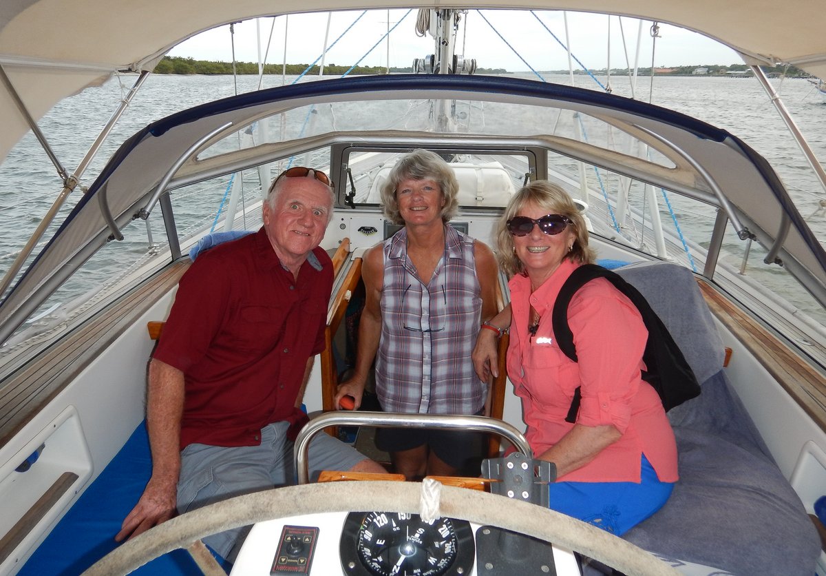
I went ashore to the Yacht Club and talked to Dave the Dockmaster, who said it was okay for us to leave our dinghy in their marina. He was very friendly and said it was free. Tony and Mary came out to see Alba and we had a good chat catching up on the last 30 years. Tony has recently given up skydiving after nearly 50 years in the sport and is very interested in sailing now. He’s looking to buy a boat, but isn’t interested in Alba because he wants a catamaran.
In the evening, Tony took us out for a meal in a posh restaurant, where we met two of their friends, Howie and Caroline, who are also skydivers and sailors. A huge thunderstorm came through just as we were leaving the restaurant, so rather than getting soaked going back to the boat, we went to Tony’s house for a cuppa tea. Thankfully, Alba was still there went we finally got back.
We’ve been living on Alba for exactly eight years today, so I worked out a few statistics. In the past 12 months, we’ve sailed 3,033 nautical miles bringing our total to 44,204 miles since we moved aboard. In the last year, we’ve run the engine for 233 hours, which at 5 knots equates to 1,165 miles and means that we’ve spent 38% of our time motoring.
9 April 2019 New Smyrna, Florida
The weather forecast for today was for thunderstorms in the afternoon, so we decided to stay put. Tony came and picked us up in his car and took us for a quick tour of the area. We drove along the hard-packed beach and had a stare at the Ponce de Lyon Inlet, which in the light winds and high tide looked very benign. Tony then took us to a supermarket where we bought a few more provisions to take advantage of the car.
After lunch, the skies cleared and we had fluffy white clouds against an azure sky. However, by 15:00, the clouds had built up and by 16:00, the wind had picked up to 20 knots from the south with dark clouds approaching from the south-west. Thirty minutes later, there were a few bright flashes of forked lightning, so we disconnected our laptop and put our phone and tablet into the oven.

We could see the torrential rain racing across the water towards us and the wind followed soon after, pushing us over to 30 degrees as it slammed into us. The visibility dropped to 20 metres and the wind howled – the highest gust was 58 knots. Fortunately, it’s good holding here and nobody around us dragged. Ten minutes after it started, the skies brightened and we were left with no wind at all. It’s serious weather here.
The ICW has been very easy to navigate so far with very dependable charts and a well-dredged channel. Further north, it’s not so good, so I spent a few hours doing some research and found that the US Army Corps of Engineers (USACE) carry out regular and continuous surveys of the ICW, and publish charts showing their actual depth readings. For $40US, I bought an Android app called Aqua Map, which acts as a chart plotter on our tablet and overlays the USACE data over the normal marine charts.
10 April 2019 New Smyrna to St Augustine , Florida
The alarm was set for 06:45, but at 06:30, I heard the sound of a boat pulling up an anchor, so I went on deck to have a look. It was pre-dawn twilight, but I could see enough to move the boat, so I dragged Glenys out of bed and we rushed to catch the 07:00 opening of the Bascule Bridge, which is north of New Smyrna. With 60 miles to go, it was good to get an early start.
The first section was through low lying marsh land, which was lovely in the early morning light. We passed through Daytona Beach, which is lined with apartment buildings and has five bridges, but fortunately only one of them was a lifting bridge. After Daytona, the landscape became more rural with the occasional run of waterside houses.
The Aqua Map app was worth every cent. It worked impeccably as a chart plotter and the overlay of the USACE charts was indispensible. There was a very tricky area near Matanzas Inlet, where the inflowing water has deposited sand on a bend. The USACE charts showed us exactly where to go and we saw nothing less than 3 metres depth.

We arrived in St Augustine at about 17:30 and went straight onto the fuel dock at the Municipal Marina to top up our diesel tanks, which cost $260 –it’s expensive doing all this motoring. While we were there we filled up our water tanks as well – we’ve not been able to run our water-maker since we entered the ICW because the water has too much sediment.
We were able to get off the dock just in time to make the 18:00 opening of the Bridge of Lions and picked up a mooring on the north side of the bridge. It was a long 60 mile, 11 hour day – motoring on the ICW is much harder that sailing along the coast because you have to concentrate on navigating the boat all the time.
11 April 2019 St Augustine, Florida
We just managed to drag ourselves out of bed before 08:30. We were planning on having a leisurely tourist day, but I decided that I ought to do a couple of jobs on the engine. The sea water pump has started to leak again, even though I replaced the seal and a bearing in January, so I tackled that first.
I’ve done this job too many times in the past 18 months, so it only took me 30 minutes to remove and strip down the pump. The spring inside the lip seal was badly rusted, so it must have been a normal steel spring instead of a stainless steel – I bought it in South Africa. I replaced the seal with a new stainless steel lip seal (which I’d bought in the UK) and rebuilt the pump.
With the pump installed on the engine, I changed the engine oil and filter. I was hoping to wait until we get to Annapolis, but we’ve done so much motoring since we left the Bahamas, that we’ve just passed the 200 hour limit between oil changes. It was a fairly painless job, so I’d finished my maintenance chores just before lunch.

In the afternoon, we went for a stroll around St Augustine, which is a very touristy town. It’s the oldest European-established settlement within the United States. The Spanish arrived in 1565 and built a fort which helped them in various battles with the English and pirates for the next 300 years, before the town was handed to the USA in 1820 in the Adams–Onís Treaty.
In the 1880s, Henry Flagler, an oil tycoon, built two very grand hotels and transformed the quaint town into the winter resort of American high society. The architecture of the large hotels and other buildings is impressive and the narrow streets of the old town are quaint, now turned into a plethora of bars, restaurants and souvenir shops.
After a couple of hours wandering, we’d just decided to go back to the boat, when Tony rang us and said he was in St Augustine having just looked at a few Catamarans. We met up and had a nice afternoon with him & Mary and then went out for an interesting evening meal at The Floridian restaurant.
12 April 2019 St Augustine to Cumberland Island, Georgia
We were up before sunset and headed off into the still, misty morning. Most of the route was through rural settings with marsh land and occasional communities. We saw many flocks of White Pelicans, which with a 9-foot wingspan, are one of the largest birds in North America. They are spend their summers in the northern state of the USA and Canada and migrate here for the winter.

There were 4 horrible sections of the ICW where shoaling has been occurring. The Aqua Map app came out with flying colours and we safely negotiated the torturous routes through the shoals – the minimum depth we saw was 3.4 metres at half tide.
After 60 miles of stress, we arrived at Fernandina Beach at about 17:00. There are two huge paper manufacturing factories either side of the town, which don’t look very attractive and the smell is awful when you’re down wind of the smoke stacks, so we carried on another 5 miles to the secluded and peaceful Cumberland Island, which is just over the state line in Georgia.
13 April 2019 Cumberland Island, Georgia
From here we want to head to Beaufort, which is 360 miles away. The ICW is too shallow for our 2 metre draft, so we need to sail along the coast, which will take 2½ to 3 days. Unfortunately the weather isn’t playing ball and we can’t get a big enough window to do that in one leg. So we’re looking to do shorter overnight passages, jumping up the coast with our next stop at Charleston, South Carolina which is 160 miles away.
After all the motoring yesterday, I decided to check the engine and to my dismay, I found that the damn sea water pump was leaking again – must be a record for it to fail after only one day. Fortunately, I had another seal, so I removed the pump and stripped it down. I couldn’t see any damage on the feather-edge lip of the seal, but there seemed to be signs of a leak past the outer edge of the seal where it fits in the pump body.

The stainless steel seal that I used did not have a rubber coating and was extremely tight in the bore of the pump body, so maybe the outer ring had distorted a little? There was also some wear on the shaft with a very shallow groove, so I cleaned up the shaft with some 1200 grit emery cloth. When I replaced the stainless steel seal, I first applied some gasket sealant to the bore to seal the outer rim of the seal. Hopefully, that will sort out the leak.
After lunch, we went ashore to the National Park on Cumberland Island. Access to the park costs $10US and the pass is valid for 5 days, which is a good deal considering that we’re trapped here for 5 days. There was no one in the small office, so we dropped our $20 dollars into an envelope and into the self-payment slot.
We spent 2½ hour walking south around some of the paths. The island is about 15 miles long and used to be owned by the wealthy Carnegie family who build the impressive Dungeness Mansion on the south end of the island. The building was destroyed in a fire in 1959, but the skeletal ruins and grounds are impressive.
Our wanderings took us to the beach, which is 17 miles of pure white sand backed by sand dunes. Further inland, the Maritime Forest has the twisted limbs of Live Oaks draped with Spanish Moss. The walks along the well prepared paths are a joy.

Around the Dungeness Mansion, we were excited to have three sightings of Nine-banded Armadillos. These animals originated from South America, but have been slowly spreading across North America. Interestingly, they have been linked to humans catching leprosy – about 50% of all Armadillos are carriers of the bacteria which causes the disease. It’s not a major problem, with 95% of humans being immune to the disease and only 150 people a year contracting it in the USA.
14 April 2019 Cumberland Island, Georgia
The weather along this coast is a challenge. Cold Fronts containing violent thunderstorms are coming through every 5-6 days and we do not want to be caught out at sea in their 50-60 knot winds. After the front has passed, the wind switches to the west and then, over the next two days veers through north and then the east. Our route to Beaufort is north east, so these winds are no good to us.
The wind then veers to the south-east and then the south, which is good for us, but unfortunately, we only have 48 hours before the next Cold Front comes sweeping across the mainland USA. We will have to time it carefully to do the overnight passages and not get caught out. The next window is on Wednesday 17th, which will give us 48 hours to sail the 160 miles to Charleston – we should arrive on Thursday morning, 12 hours ahead of the storm.
From our recollections and research, the anchorages in Charleston are uncomfortable and/or full of wreckage, so we’re going to swallow the pain and pay $80-100 US per night to go into a marina while a front goes through on Friday next week.

Meanwhile, a front is racing across the southern states and Georgia has a severe weather warning in force recommending that people review their Tornado plans – gulp. We’re anchored in 4-6 metres depth on what appears to be good holding, but strangely, the anchorage has emptied and we’re in splendid isolation now. I let out 40 metres of chain and we waited with baited breath to see what the evening and night brings.
I ran the engine for 15 minutes and the sea water pump was not leaking, so fingers crossed, that problem is solved.
We spent the rest of the day on-board, watching the skies. By the evening, the wind had picked up to 20 knots from the south, coming straight up the channel in which we’re anchored. Normally, 20 knots wouldn’t affect us, but the tidal current was flowing south, so we were pushed side onto the wind and the 18 inch wind waves, making us bounce around and heel over in the gusts.
A huge band of thunder storms was approaching from the south west, so it looked like an uncomfortable night ahead. The only sensible thing to do was close the hatches, open a bottle of red wine and watch a few episodes Game of Thrones. Fortunately, the thunderstorms dissipated as they approached us and by 22:00, we had clear, star-lit skies.
15 April 2019 Cumberland Island, Georgia
It was very cold last night (about 15°C) with a brisk 20 knot SW wind, which is sucking cold air from the central states of the USA – we had to put on fleeces while having breakfast and the hot cup of tea was very welcome. However, it was sunny and the forecast still looks like we’ll have a weather window to leave for Charleston on Wednesday 17th.
After breakfast, Glenys made some bread, while I tackled a problem on the front toilet. The pump wasn’t sucking in any sea water to flush the toilet, so I removed the pump to find a small ½” crab jammed under one of the valves. I pulled the (dead) crab out and voila! a working toilet – you don’t have these problems when living in a house.

We went ashore and hiked north up the beach on the Atlantic side of the island which was very sheltered from the SW wind. There were a surprising number of Horseshoe Crab carcasses along the high tide water line. These strange creatures grow to be 20” diameter and are more closely related to spiders than true crabs. They crawl around the seabed searching for worms and molluscs, which are their main food. Horseshoe Crabs lay and fertilise eggs at the high-tide waterline and about 10% of the population dies when rough surf flips them onto their backs, a position from which they often cannot right themselves.

After walking a few miles along the beach, we headed inland and continued walking north along a narrow path through the Maritime Forest beneath the thousands of Live Oak trees. A number of campsites are hidden away beneath the trees and seem to be very popular with backpackers. We were only able to get halfway up the island before we turned around and headed back to the boat – a pleasant 10 mile hike.
16 April 2019 Cumberland Island, Georgia
We woke to blue skies again. It was chilly in the morning, but not as bad as yesterday because the wind was only 10 knots from the north-east pulling in air from the warmer Atlantic Ocean. The forecast is still showing SE 10-15 tomorrow, increasing to S 15-20 overnight, so we’ll be heading to Charleston tomorrow. The next front arrives at the coast on Friday 19th, so we have over 48 hours to sail the 160 miles.
The next front looks like another strong one, with forecast gusts over 45 knots on Friday night, so we’ve booked ourselves into a marina for two nights. It’s going to cost $80US per night, but we’ll be able to explore Charleston city instead of worrying about the storm front.

We pottered about on the boat all day. Glenys spent most of the day slaving away on her sewing machine, reinforcing and patching the bimini, the side panels and the dinghy cover. I went up the mast and replaced our VHF antenna – we won’t be going under any bridges until we get to Beaufort. After Glenys had finished the repairs to the dinghy cover, I lashed the dinghy onto the front deck and prepared to go sailing tomorrow.
I checked the engine and the damn water pump still has a very slight leak. It must be the slight groove in the shaft causing the leak, so there’s not a lot I can do about it at the moment. I’ll just have to keep a very close eye on the pump and hope that it lasts until we get to Annapolis – we’ll probably be motoring for 100 hours, but I think that we’ll be okay.
I did some research on my options. I could buy a new pump for a staggering $600US; or buy a new shaft for $250US; or I can buy a SKF Speedi Sleeve and a new seal for $25US. The Speedi Sleeve is a very thin tube which is an interference fit on a shaft, covering any grooves in the shaft, providing a smooth sealing surface. The sleeve is made from hardened stainless steel, so I think that it is a strong repair, but I need to investigate further.
17 April 2019 Cumberland Island to Charleston, South Carolina (Day 1)
The anchorage at dawn was like a mill pond. We pulled up the anchor just after 07:00 and motored the 5 miles to the inlet. There was a very light east wind, putting us very close hauled on starboard tack, but not enough wind to sail. We motor-sailed all day, hoping and waiting for the wind to increase and veer to the south-east. Fortunately, the seawater pump is behaving itself.

In the morning, I hooked and landed a small mackerel, which we had for lunch. As usual on our watches, I slept for a couple of hours in the afternoon, waking to find that Glenys had landed two very nice Bonito Tuna. I gutted and filleted them and Glenys packed them in zip lock bags in the fridge. She’d already made a stew for today’s dinner, so the fish will have to wait.
At 18:00, as we were having dinner, the wind finally picked up enough to sail. We were still hard on the wind, but in the very calm seas it was a pleasure. As the sun set, the skies were overcast, but mostly stratus clouds - nothing to be worried about. There was a full moon, so it was a glorious night. Our route is taking us 25 miles off shore, but the water is surprisingly shallow at 20-30 metres. During my 7-10 watch, I was amazed to pass a 335 metre long cargo ship at anchor, 23 miles offshore.
Yesterday, while reviewing the weather forecast, I’d looked up a forecast for the currents along this coast. The strong Gulf Stream is 40-50 miles offshore in this area, so it is of little help. The forecast was showing a 0.4 – 1.0 knot counter-current along our route, so I considered taking a longer route to try to avoid the worst of it, but eventually decided to sail the rhumb-line and take my chances. I’m glad that I did because the worst we saw was 0.5 knots against us and most of the way we had a slightly favourable current.
The wind dropped at our 22:00 watch change, so it was back to motor-sailing for a few hours and then Glenys managed to sail for a couple of hours on her 4-7 watch.
18 April 2019 Cumberland Island to Charleston, South Carolina (Day 2)
We had a lovely sunny start to the day, motoring towards the busy port of Charleston. At 10:00, we were just entering the inlet channel, but we were unlucky with the tidal current, which was against us. It was very slow going with counter currents up to 4 knots, so it took us two hours to get into the harbour .

Although we’d booked into a marina, we didn’t want to try to enter our berth until the tides had calmed down, so we anchored about ½ mile away at 32°45.45N 079°55.16W in 5 metres depth and had lunch. A couple of hours later, we pulled up the anchor and motored over to the Charleston Maritime Centre, where we easily docked at slack water.
In the evening, we went for a stroll into the old town intending to have a beer and then dinner. It’s the start of the long Easter weekend, so the place was heaving with tourists. We had a beer in a bar and then went to look for a restaurant serving local creole food, but the ones that we tried were fully booked with no tables available until eight o’clock.
Disappointingly, the only restaurants that had space were places serving burger and fried food. There was no point in paying expensive tourist prices for mundane food, so we headed back to the boat; bought a Dominos’ pizza on the way; cracked open a bottle of merlot; and watched a couple more episodes of Game of Thrones – we’re now half way through Season 3.
19 April 2019 Charleston Maritime Centre, South Carolina
The leading edge of the front arrived before we’d got out of bed and started with a mere 25 knots of wind and some rain. By the time that we’d had breakfast, the skies were brightening up, but on the weather radar, we could see the main front would be with us mid-afternoon. We abandoned our plan of walking around town to take in the tourist sights and instead, we did some chores.
Glenys took advantage of the free laundry facilities and did two big bags loads of washing. Meanwhile, I topped up our water tanks and then walked ½ mile to the supermarket, where I bought a case of beer and enough wine to last us until Annapolis. I loaded it all into my rucksack & two shopping bags and hauled the 22 Kg of booze back to the boat. By this time, Glenys was ready to go to the supermarket, so I went with her and helped to lug back more provisions.

After lunch, the wind picked up to about 30 knots. The marina doesn’t have a protective sea wall, relying on the floating pontoons to calm down the waves. Unfortunately, the waves increased to 2-3 feet, so we were bouncing around in our berth. It’s not the best marina in the world, but it’s the cheapest in Charleston and better than being in an exposed anchorage. Thankfully, we had a tourist ferry moored in front of us which helped to block the wind and waves.
In the middle of the afternoon, the skies darkened and the first squall hit us with winds of 45 knots, heeling us over at 15° with lashing rain reducing visibility down to 15 metres. Lightning flashed and thunder boomed, so the electronics went into the oven. It was all over 15 minutes later. This front was much broader than the previous ones and the wind continued to gust up to 30 knots until we went to bed.
20 April 2019 Charleston to Wando River, South Carolina
We woke to a cold, 15 knot south-west wind and blue skies. After topping up our water tanks and dumping our garbage, we caught the rising tide and headed up the Wando River for five miles. We went under two very high bridges and past a large container port with 3 huge container ships being unloaded. About a mile past the second bridge, we anchored in 4 metres depth at 32°52.01N 079°52.42W. There’s a mile fetch to the west, but it’s a lovely spot with woods lining the shore.
Unfortunately, just as the tide turned to go out, the wind picked up from the south-west at 20-25 knots. We had wind against tide for 6 hours with waves building up to 2-3 feet. To make matters worse, the tidal current pushed the stern upwind, so the waves were slapping us on the sugar scoop sounding like we kept hitting something.
Alba was being pushed so strongly by the tide that the anchor chain was rubbing against the side of the hull, scraping off antifoul paint. The cold wind was blowing straight down our companionway into the saloon, so we were forced to shut everything and wear jumpers. It was so unpleasant that I went to bed and read a book for a few hours. I hate being in places with a strong tide.

By 16:30, the tide had turned and the boat turned bow into the wind, so that life became tolerable again. The wind slowly dropped and by bedtime it was fairly calm.
21 April 2019 Wando River to Charleston, South Carolina
Our lives are totally dominated by the weather. I spent two hours checking the weather and planning different routes north. The forecast is for some north winds tonight and then it will be south-west for the next three days – starting very light and increasing to 20 knots. The next frontal system doesn’t arrive until Friday 26th, so if we leave tomorrow, we should have a 4 day weather window, which is enough for us to sail 440 miles, all the way to the Chesapeake.
The timing of the tides tomorrow is not very good because the tide is streaming into the harbour at 07:00. We either wait until 11:00 to get a push from the tide or we leave at 04:00 before the tide turns – we’ve decided to bite the bullet and leave before dawn, which will be unpleasant, but we’ll gain an extra seven hours, giving us a bigger weather window.
When the tide turned at 11:30, we pulled up the anchor and headed down river back to Charleston Anchorage, where we anchored at 32°45.87N 079°56.03W in 6 metres depth. It’s an exposed place just off the channel and the current rips past, but it will afford us an easy start in the middle of the night. The wind was blowing hard from the north-west, so we were expecting to be bounced around in the evening when the tide turned, but fortunately, the wind dropped and we had a lovely, if cold evening.
22 April 2019 Charleston to Chesapeake (Day 1)
At 04:00, we pulled up the anchor and set off into the night. There was no wind at all, but we had a favourable current of 1½ knots for the 10 miles out of the inlet channel. We then set off on a course of 075° aiming for the 200 metres depth contour, hoping that by the end of the day, we’ll pick up the strong Gulf Stream to push us north.
It was a mind-numbing day, motoring at 6 knots with the occasional periods of light winds allowing us to add a few tenths of a knot by motor-sailing. The sea water pump is still dripping and is a constant worry to me, although (touch wood) it’s only a very small drip. By mid-afternoon, we’d entered an area of slightly adverse current, so we changed course by 20° and headed directly east towards deeper water.

At about 17:00, we crossed the 100 metre contour and finally entered the edge of the Gulf Stream enjoying a 1½ knot push, so we came back on course following the contour. Unfortunately, this only lasted for a hour, before the current dropped down to less than ½ knot. We then had 3 hours with up to ½ knot against us again, despite sneaking further east to the 200 metre contour.
The night was lovely with a ¾ moon and clear skies, but the wind remained light and we couldn’t find the elusive Gulf Stream.
23 April 2019 Charleston to Chesapeake (Day 2)
At dawn the wind picked up enough that Glenys was able to turn off the engine after 26 remorseless hours of motoring. When I got up at 07:00, I checked the sea water pump and cleaned off the thick salt deposits that had built up under the pump.
I don’t think that the seal will fail catastrophically, instead I think that the drip will just get worse. My main worry is that the continual dripping of hot saltwater will quickly corrode the bearing in the pump, so I doused the pump in fresh water and sprayed WD40 on the shaft and the visible face of the bearing to try to disperse the water.
By 09:00, the wind had become very flukey, ranging between 5 and 12 knots, so progress under our normal sails was frustrating. We eventually dragged out our asymmetrical spinnaker and spent 20 minutes getting it flying. I think the last time that we had the spinnaker flying was crossing the South Atlantic a year ago.

Meanwhile, on AIS, I spotted a sailing yacht called “Ultimo”, who were about 8 miles further east than us, so I called them up and asked if they had found the Gulf Stream. They thought that they had 2-3 knots in their favour, so we put a track on their AIS position and changed course by 20° to head more east to see if we could find the current.
We found ½ knot and then as we came back on course, it slowly built to 2 knots over the rest of the day. Unfortunately, before lunch, the wind dropped and veered to the north, so I had to drop the spinnaker and turn on the engine again. The leak on the sea water pump is gradually getting worse, but fingers crossed, it’ll be okay to get us up to Annapolis, where I can repair it at my leisure.
Before dark, we listened to the weather forecast and there’s going to be south-west winds at 15-25 knots as we go around Cape Hatteras tonight and tomorrow morning. Hopefully, the seas won’t build too much and in preparation of us running downwind, I rigged up the spinnaker pole to port before night fell.
A light, 10-12 knot south-west wind arrived at 19:00, allowing us to turn off the engine and run down-wind with the sails wing-on-wing. It was lovely gliding along at 5-6 knots and even better that we had up to 4 knots of current with us.
By the time that we approached our turning point around Cape Hatteras, the wind had picked up to 20-25 knots and we had put two reefs in the main and 5 wraps in the genoa. It was a little bouncy as we turned 30° degrees to head north on a beam reach, but nothing too bad and the seas calmed down once we were in the lee of the coast.
24 April 2019 Charleston to Chesapeake (Day 3)
At dawn, we still had 85 miles to get to the Chesapeake Bridge, so it was likely that we wouldn’t get into the Chesapeake until well after dark. The strong SW winds slowly veered and decreased during the morning, allowing us to shake the reefs out of our sails.

We’ve been debating where to stay when we arrive in Annapolis. There are a few anchorages about, but they can be crowded and you’re supposed to register with the Harbour Master if you stay within the city limits for more than 3 days. The mooring fields are very expensive at $25-35 per night. I rang Herrington Harbour North, where we’re going to haul out and they can offer a berth in their marina for a special rate of $550/month, which is $18 per day.
After a little discussion, we decided to stay at the marina and, if we’re going to arrive in the Chesapeake in the dark, we might as well carry on overnight up to Herrington Harbour. The forecast is for light winds overnight and tomorrow, so we’d have to motor all the way, but we’d be in the Annapolis area for the boat show that starts on 27th – you never know someone might want to view the boat. I rang the marina and booked us in from tomorrow night.
In the early afternoon, the wind died and we had to turn on the engine again. I checked the sea water pump and there was significantly more water coming out of the seal – it didn’t look good and I was unhappy with the thought of motoring for another 36 hours. I dug out our spare water pump and had a look at the condition of it – as suspected, the seal that I’d replaced in South Africa was not a stainless steel one, so the seal on that pump was useless as well. We switched to Plan B – we’d stop in Norfolk and I’ll buy some new parts to rebuild both pumps.
I did some ringing around and made some email enquiries. I’m going to buy enough spares to fix the two pumps plus a spare set of bearings and a seal. It will probably cost me $150 but at least I should have a working pump plus a good spare. I also rang the local Ocean Cruising Club officers who said that they will drive me around tomorrow to find the parts and, as a bonus, they have a dock that we can use for free for a few nights.
By this time, we still had 50 miles to go – it’s a long length of coast-line from Cape Hatteras to Norfolk. The sea was very calm as we motored along, so I pulled the spare pump apart, so that it’s ready to repair tomorrow.
The tide turned as we approached Cape Henry and it was slow going with our speed over the ground dropping to 3.4 knots as it went dark. We finally arrived at Comfort Point at 23:15, edged our way into the anchorage and with great relief, dropped the hook. The 425 mile trip from Charleston took us 67 hours and we only sailed for 22 hours, which meant that I was stressed up for 45 hours, while motoring with a leaking pump. The first cold beer tasted fabulous.
25 April 2019 Comfort Point to Norfolk, Virginia
We were up at 07:00 and motored 11 miles into the centre of Norfolk, where we pulled into a private dock owned by Gary and Greta, who are the Ocean Cruising Club officers for the area. They live in a condominium right on the water front, which has a dock for each apartment, but many apartments don’t have boats, so Gary and Greta are able to make the docks available for OCC members at no cost.

In the morning, Gary took us out on the hunt for parts for the water pump. We went to Norfolk Bearings, who didn’t have the parts I wanted, but are able to get them sent by overnight delivery, so I ordered the parts and hope that they will arrive tomorrow morning. If all goes according to plan, I should be able to repair both pumps tomorrow and we can head up to Annapolis on the 27th – the weather looks good with 15-20 knot west winds, which will be perfect.
After lunch, Greta took Glenys out to the supermarket, while I removed the water pump from the engine and stripped it down, ready to fit the new parts tomorrow. In the evening, we had a few drinks with Gary and Greta on their patio.
26 April 2019 Norfolk, Virginia
Gary drove me to pick up the spare parts, which cost $120. Unfortunately, the cost of shipping the parts overnight was a staggering $200! The parts had come from two separate locations and each delivery cost $100. If kicking myself for asking for morning delivery without asking how much it would cost. To make matters worse, tomorrow’s weather window has gone away and we can’t leave for a few days, so I could have had a cheaper, normal delivery.
Back at the boat, I fitted Speedi Sleeves onto both of the shafts. Both shafts have grooves worn in by the lip seals and the Speedi Sleeves covered the grooves very well. They were also surprisingly easy to fit – I just had to tap them on using a tool provided with the kit. I rebuilt the older pump and then fitted it onto the engine, running it for 15 minutes to test that it worked without leaking.
I then rebuilt the newer pump and fitted that onto the engine. I washed the older pump with freshwater to prevent any corrosion and it’s gone away into my spares cupboard. Spending $320 on spare parts was a bit of a shock, but I now have two working pumps for half the cost of a new pump.

A cold front came through in the afternoon, bringing 45 knot winds, lightning and lashing rain. We hunkered down below all day.
27 April 2019 Norfolk, Virginia
The cold front moved east overnight and has left us with strong westerly winds – we have blue skies, but it’s very cold. I ran our cabin heater this morning to take off the chill – it’s the first time that it’s been used for three years. There’s a nasty looking low pressure system forming to the west of us and it’s going to get here tomorrow night, so we’re going to wait for that to pass over before heading up to Annapolis on the 29th or 30th.
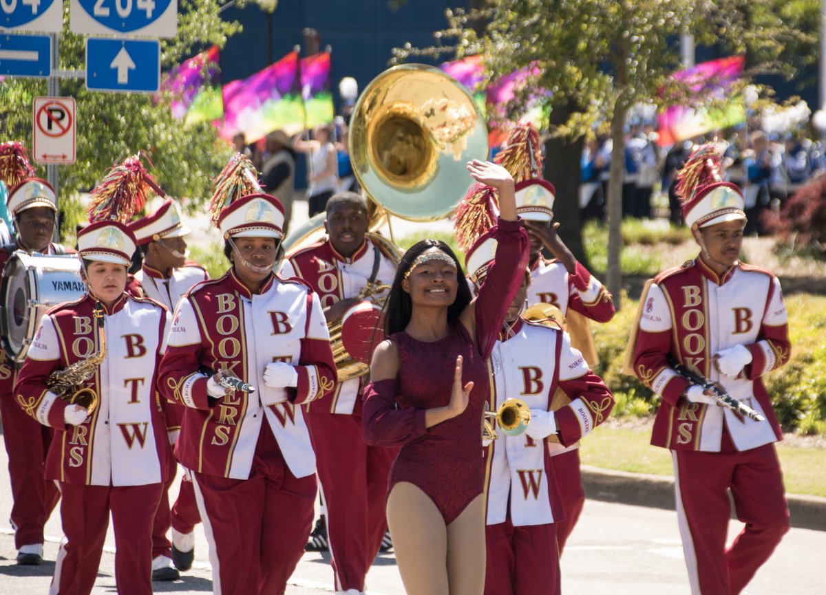
After breakfast, we walked down to the Waterfront Park to watch a parade celebrating NATO. There were floats from every country in NATO as well as high school marching bands and the odd Bagpipe band. It was an interesting American event with the State Police riding past on their Harley Davidson motorbikes and cheer-leaders in the high school band, twirling flags.
We persevered until the Portugal float and then went for a walk around town. It’s a surprisingly nice city, with parks and fountains. We had lunch at a sandwich joint and I couldn’t resist having a Philly Cheese Steak. I haven’t had one for six years and really enjoyed it although it exceeded my weekly meat and fat allowance.
In the afternoon, we went to another event, which was a bag-pipe band contest. We watched one band dressed in Scottish kilts, who were good, but we have a low threshold for bagpipe music, so we moved on after they’d finished. Glenys had read that the Neon area of town has lots of street art, so we had a look – lots of huge paintings on the sides of buildings, but not as interesting as the street art in Penang in Malaysia.
We had a brief stop in a gun shop, where there were racks and racks of pistols and meaner weapons. I didn’t have a clue what I was looking at, but you can buy a 9mm semi-automatic pistol for $500 and a machine gun for $1500. I read that 40% of all the guns in the world are owned by American citizens and that there are 1.2 guns per person.
After scaring ourselves looking at guns, we went for a walk through the residential district of Ghent and then returned to our boat via the Elizabeth River Trail. It was interesting to walk through the tree lined suburbs with some fabulous houses.
28 April 2019 Norfolk, Virginia
It looks like the weather is going to stay against us until Tuesday 30th, so we had a lazy day messing about on the internet doing some forward planning for when we go home to the UK in June. In the afternoon, we walked into town with the idea of going to watch a movie, but being a Sunday, the movie theatre was heaving, so we decided to wait until tomorrow.
Sven and Kiki arrived on “Balance” a Swedish HR39. In the evening, Greta and Gary invited us all to their apartment for dinner of pizza –we had a good time discovering which other cruisers we all knew – it’s a small world.
29 April 2019 Norfolk, Virginia
It was a cold grey morning, forcing me to wear jeans and thick socks for the first time in six months. We’re just hanging about waiting to sail up to Annapolis tomorrow. Glenys went for a walk to the supermarket a mile away, while I lurked down below hugging a cup of hot chocolate.
In the afternoon, we walked to the cinema and watched an Avengers movie.

30 April 2019 Norfolk to Herrington Harbour North, Virginia (Day 1)
The weather forecast looked good to go, so we left at 08:00. A lot of pushing and grunting was required to get ourselves clear of the pilings - it’s much easier to anchor. We nipped into the marina across the river and bought 20 gallons of diesel, just in case we had to motor all the way to Annapolis.
For once we had the tide with us and we had a nice sail down towards Comfort Point past the container yards and the Navy warships. Once we left the river, the wind dropped, so we were forced to motor-sail all day, mostly with a ½ knot current against us, albeit with nice blue skies.
After lunch, we were invaded by a plague of flies, which looked like normal house flies, but had a vicious bite. Most of our afternoon was spent wandering around the deck swatting the little buggers.
The wind picked up after dinner and my 7-10 watch was very pleasant, sailing with a favourable tide under a clear, starry sky. By midnight, a solid layer of clouds had rolled in, bringing stronger 18-22 knot west winds, so Glenys reefed us down to a staysail and two reefs in the main. It was pitch black and cold – fleeces, trousers, hats and wind proof jackets were needed.
There were a fair number of large ships travelling up and down the Chesapeake, so we had to keep a wary eye on them. Both Glenys and I called up a couple of ships to confirm their intentions because the channel twists and turns making it difficult to predict what they are going to do.
The wind dropped down to 10-15 knots at 03:00, so I pulled out the genoa again. By 04:00, we had the engine back on.